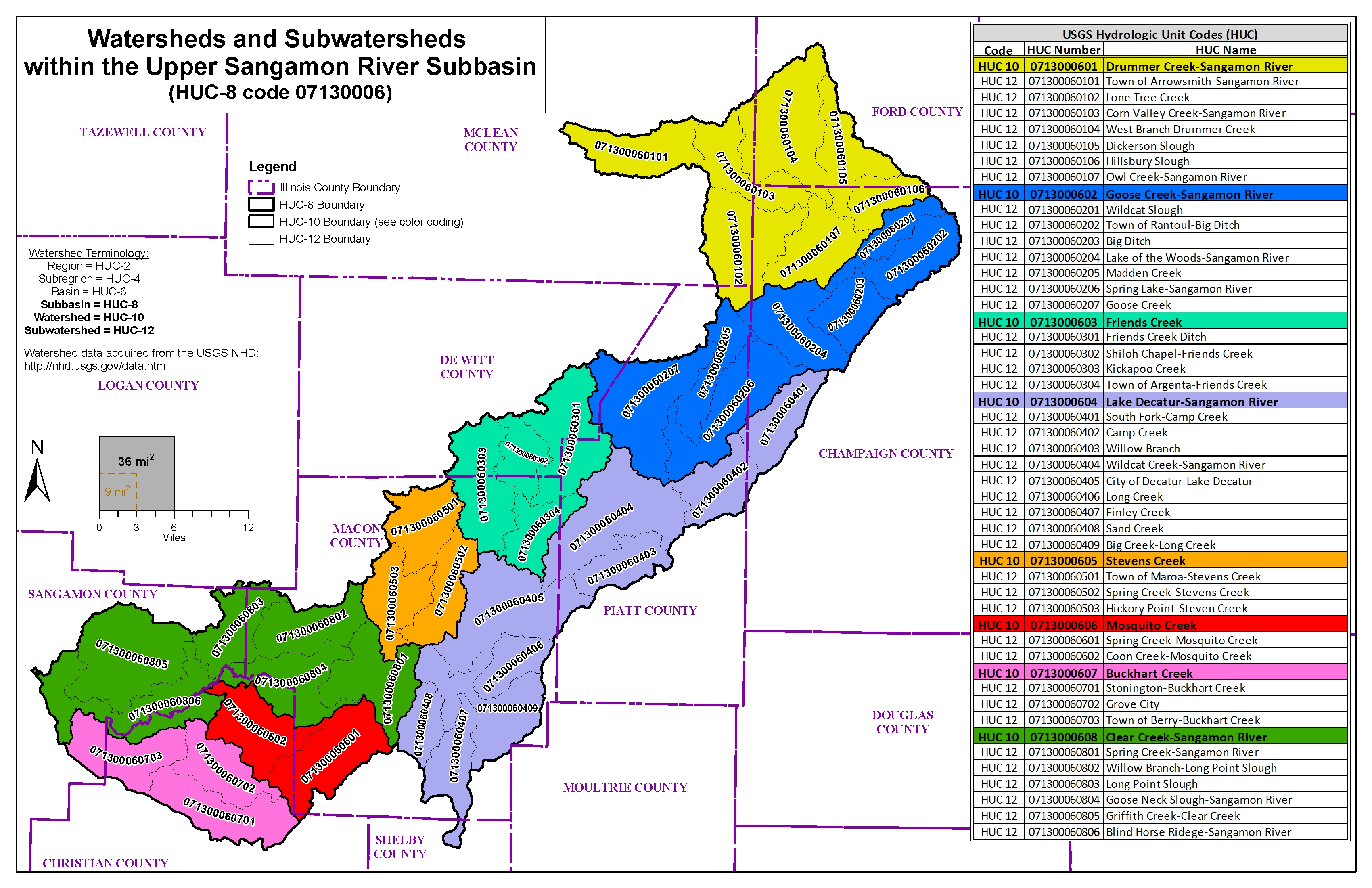
Drainage area of the Upper Sangamon River is 1,150 square miles.
The Upper Sangamon Watershed is located in central Illinois and encompasses large sections of McLean, Champaign, Piatt, DeWitt, Macon, Christian, and Sangamon Counties. The river also reaches within small portions of Shelby, Ford, and Logan Counties.
The information below is for historical reference. The Discovery process for this watershed is complete and the data is considered archival.
Drainage area of the Upper Sangamon River is 1,150 square miles.
 Copyright ©
2026
- All Rights Reserved - University of Illinois Board of Trustees | Email CHAMP | (217) 244-3372
Copyright ©
2026
- All Rights Reserved - University of Illinois Board of Trustees | Email CHAMP | (217) 244-3372
Template by OS Templates