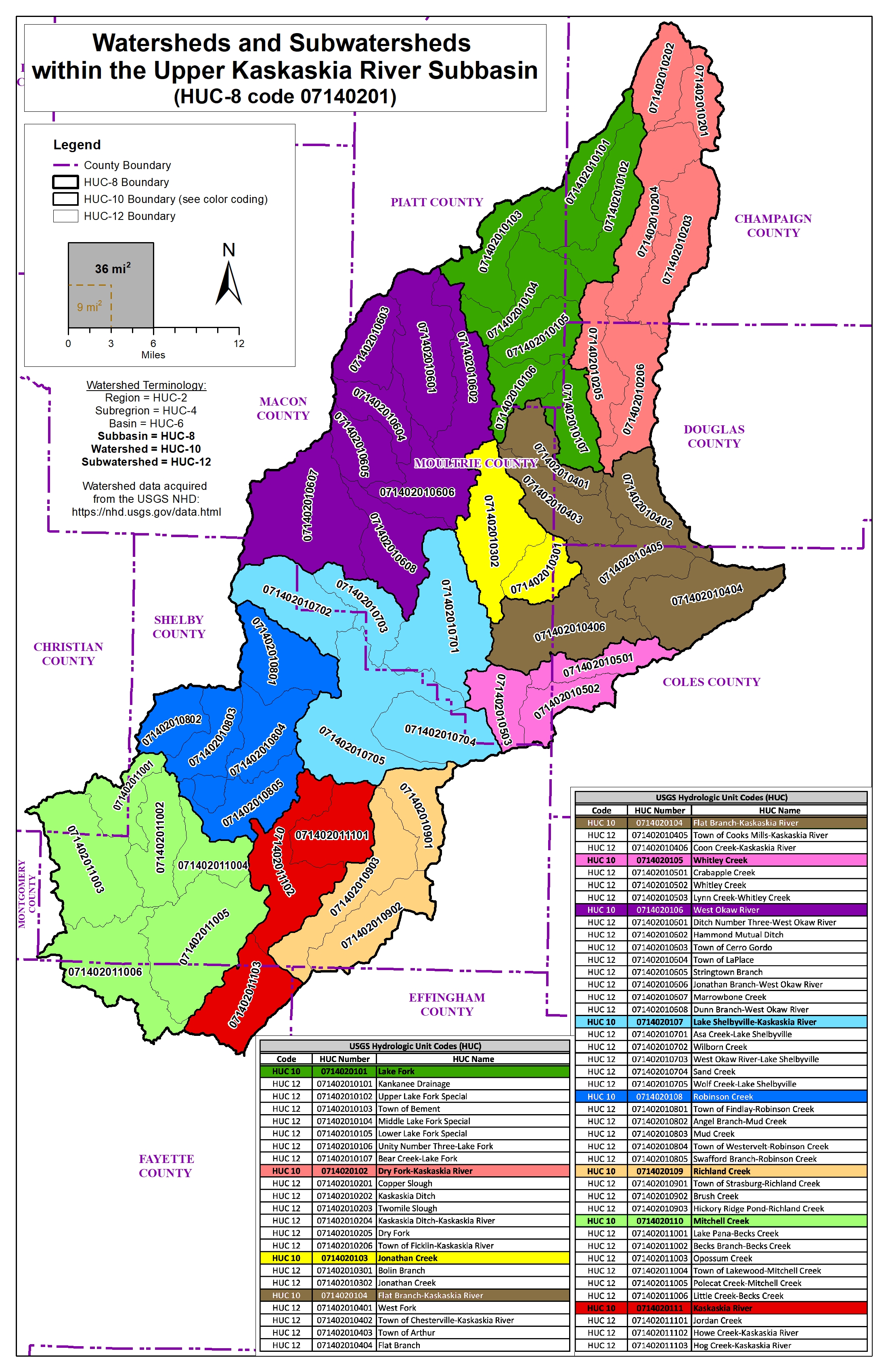
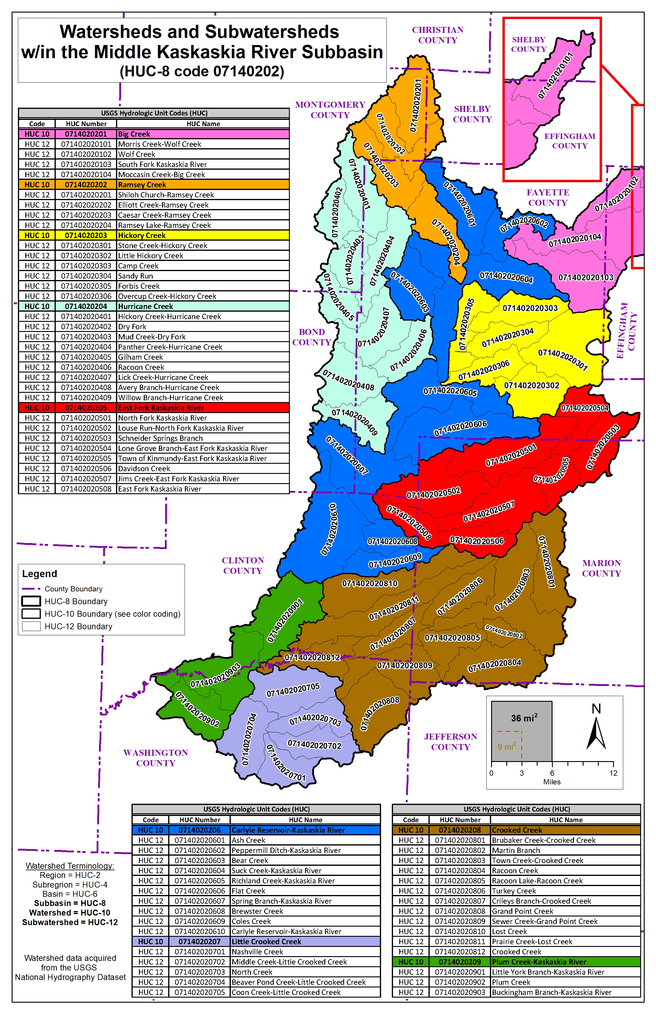
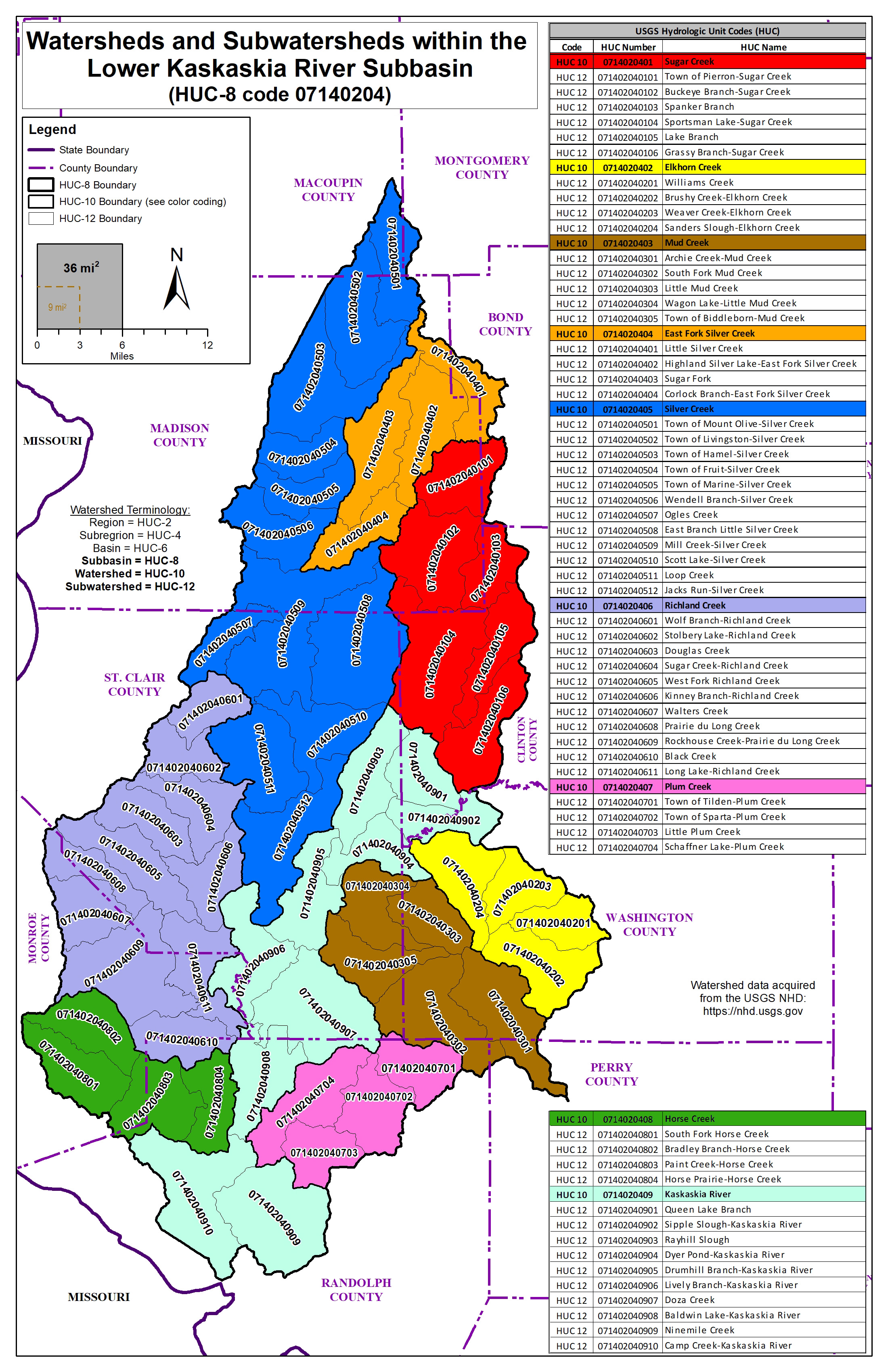
The Kaskaskia River is the main stem for three HUC-8 watersheds. These watersheds include portions of Champaign, Piatt, Douglas, Coles, Moultrie, Macon, Shelby, Christian, Effingham, Fayette, Montgomery, Bond, Marion, Clinton, Jefferson, Washington, Macoupin, Madison, St. Clair, Monroe, Randolph, and Perry counties in Illinois.
Mar 27, 2024
The Illinois State Water Survey (ISWS) is collecting data within the Upper, Middle, and Lower Kaskaskia River watersheds as part of a multiple-phase hydrologic and hydraulic study to help local communities identify areas of high flood risk for flood mitigation planning. Results from the new study will be used to update the Federal Emergency Management Agency (FEMA) Flood Insurance Rate Maps (FIRMs) and Flood Insurance Studies (FIS), which typically depict the 1% and 0.2% annual-chance floodplains.
 Copyright ©
2026
- All Rights Reserved - University of Illinois Board of Trustees | Email CHAMP | (217) 244-3372
Copyright ©
2026
- All Rights Reserved - University of Illinois Board of Trustees | Email CHAMP | (217) 244-3372
Template by OS Templates