Illinois counties with ongoing data development or mapping:
AlexanderJohnson
Massac
Pope
Pulaski
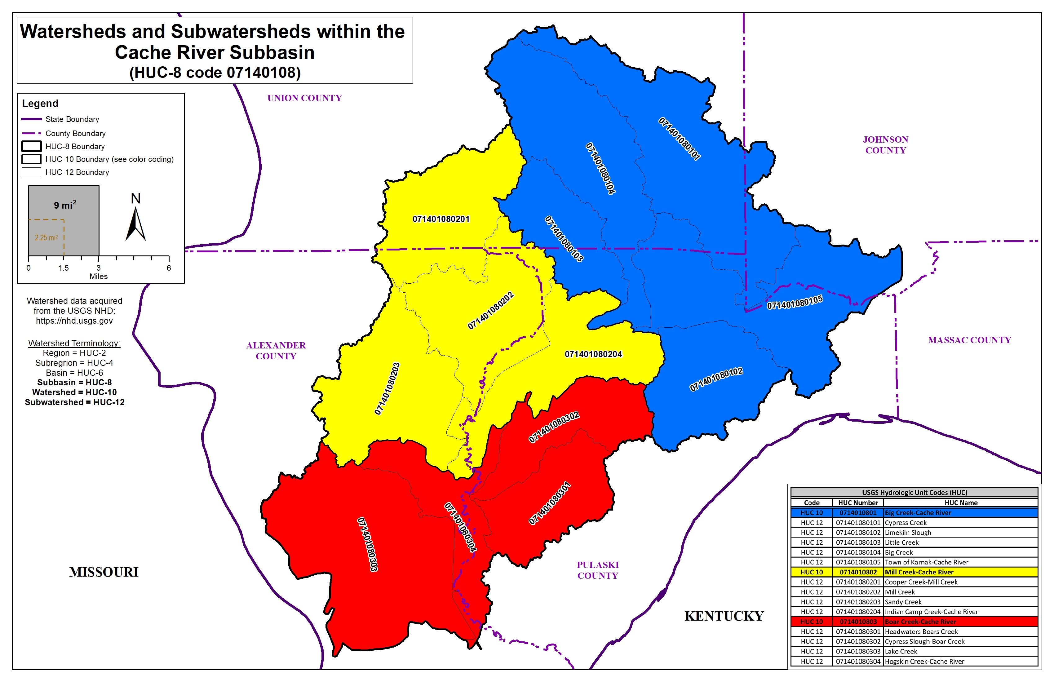
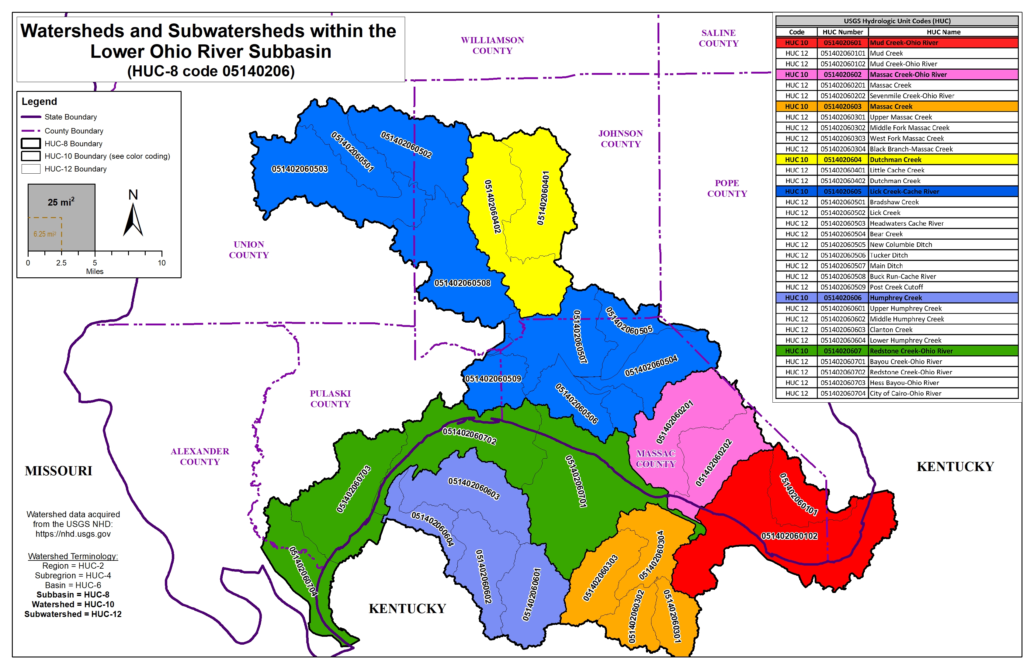
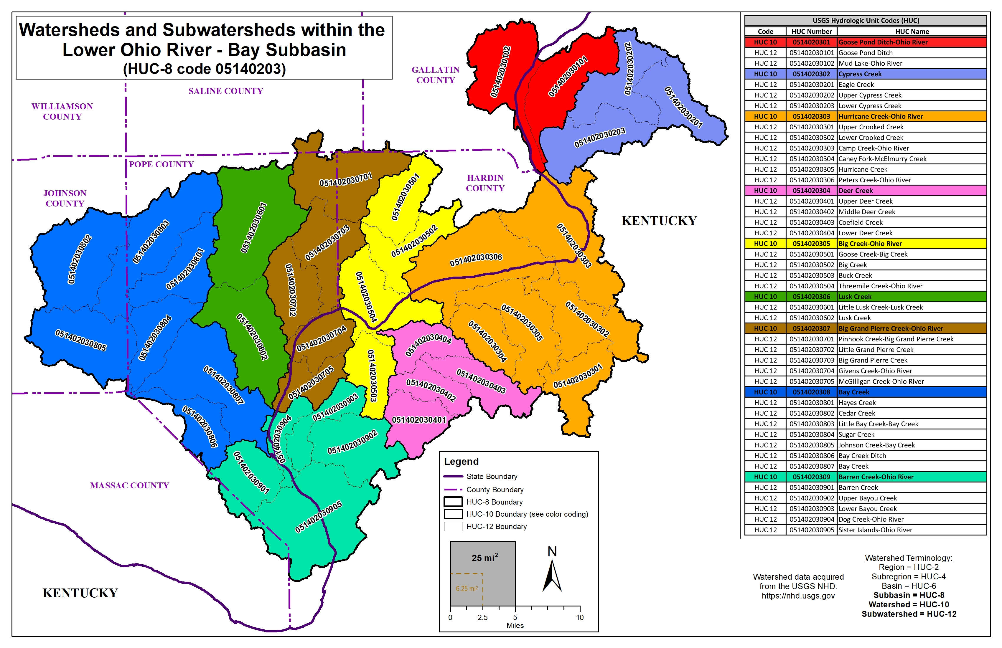
The Cache River Valley includes portions of three HUC-8 watersheds. It is a hydraulically complex area that includes a former path of the Ohio River.
Jun 21, 2022
Hydrologic models based on lidar data can be created to see how water flows over a landscape, under bridges, and through culverts. Modeling can predict where bottlenecks might occur and where that potential overflow water would flood into. Modeling can also reveal the locations of flood plains, indicating what structures would be affected by a flood event and help to map out evacuation routes that would not likely be underwater..
The information below is for historical reference. The Discovery process for this watershed is complete and the data is considered archival.
 Copyright ©
2026
- All Rights Reserved - University of Illinois Board of Trustees | Email CHAMP | (217) 244-3372
Copyright ©
2026
- All Rights Reserved - University of Illinois Board of Trustees | Email CHAMP | (217) 244-3372
Template by OS Templates