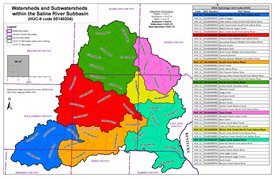
A meandering swampy river, once a source of salt from the numerous salt springs, in the past it was navigable by glass-bottomed boats from the Ohio River to Harrisburg. Drainage area is 1,762 square miles with major tributaries of South Fork, Middle Fork and North Fork.
SALINE RIVER WATERSHED (HUC 05140204)
The Saline River Watershed encompasses large sections of southern Illinois, draining Saline, Gallatin, Hamilton, White, Williamson, and Hardin Counties. The river also reaches within small portions of Franklin, Johnson, and Pope Counties.
Saline and Skillet Watersheds - White and Gallatin Counties
Project Initiation Coordination Call
12/5/2023
- Meeting Recording:
 Watch Video (hosted on Illinois Media Space)
 Download MP4 (301 MB)
 Meeting Presentation (PDF)
The information below is for historical reference. The Discovery process for this watershed is complete and the data is considered archival.
Action Discovery Materials, October 2014
 Updated Discovery Report for Saline Watershed (PDF)
 Saline Watershed Action Discovery Map (PDF)
 Areas of Mitigation Interest (AoMI) Dataset for Saline Watershed (ZIP)
Discovery Materials, November 2011
 Discovery Map for Saline Watershed (PDF)
 Saline Watershed Discovery Database (ZIP)
 Discovery Map Data Layers (PDF)

