SAFR is the product of collaboration between the Illinois Department of Natural Resources (IDNR) and the Illinois State Water Survey (ISWS). It provides access to digital data about structures in Illinois and their flood risk. SAFR is password-protected. The intended audiences are state and local officials and agency staff; in particular, floodplain managers, mitigation officers, and city planners. It is not intended for use by the general public.
In 2021, IDNR and ISWS were awarded the fifth annual CTP Recognition Award by FEMA for their work on SAFR. See the Story Map that was created by FEMA as part of the award.
Link to the SAFR web map:
SAFR is password-protected. If you work in one of the sectors listed in the first paragraph of this page and would like to request access, please email the Mitigation & Planning group: mitigation@isws.illinois.edu
See the SAFR web map at: https://go.illinois.edu/SAFR
SAFR User Guide:
The SAFR User Guide explains the basics of the web map and includes a step-by-step walkthrough of how to use it.![]() Download SAFR User Guide (PDF)
Download SAFR User Guide (PDF)
The accompanying SAFR Tutorial Video includes an explanation of SAFR data and demonstrations of how to use the web map.![]() SAFR Tutorial Video (hosted on Media Space)
SAFR Tutorial Video (hosted on Media Space)
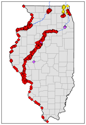
Summary of Projects Included:
Please note that projects are generally listed by the county they are located in. This does not mean that there is data for the entire county as most projects only cover part of a county, such as the Mississippi or Illinois Rivers.
Web Map Features:
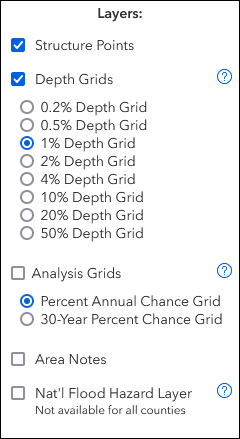
Layer List
Layers available include structure points, depth grids, analysis grids, and FEMA's National Flood Hazard Layer. Layers can be turned on and off.
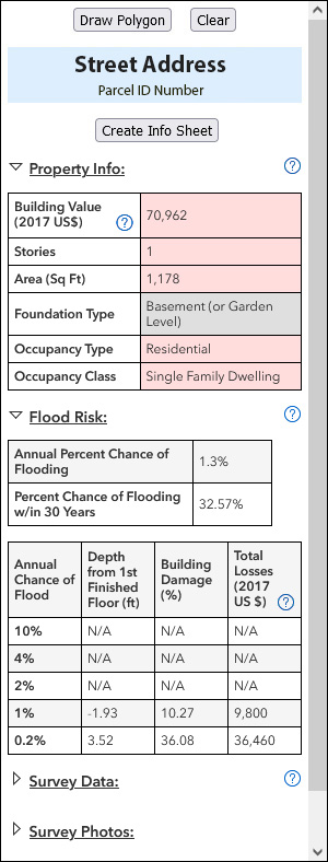
Structure Info
View data for an individual structure by clicking on its point. Data may include basic property info, flood risk, and survey data.
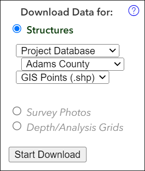
Download
Data shown on SAFR can be downloaded. Formats vary depending on the type of data.
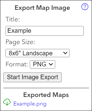
Map Export
A map showing the current view can be exported in a variety of sizes and image file formats.
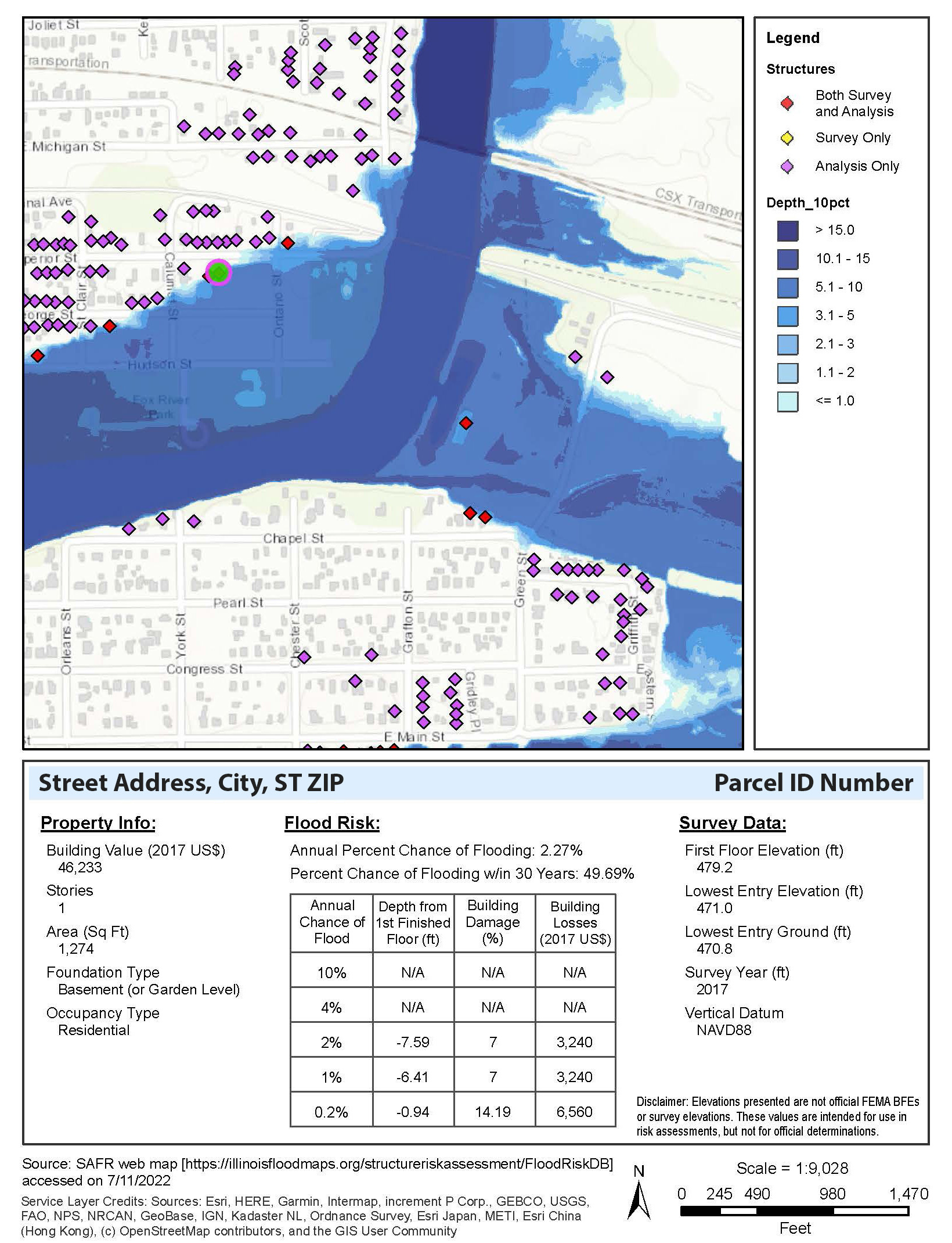
Exportable Structure Info Sheet
A PDF can be created showing information about an individual structure.
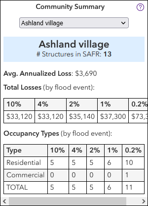
Community Summary
The Community Summary can provide a snapshot of the risk for all structures within a jurisdiction.
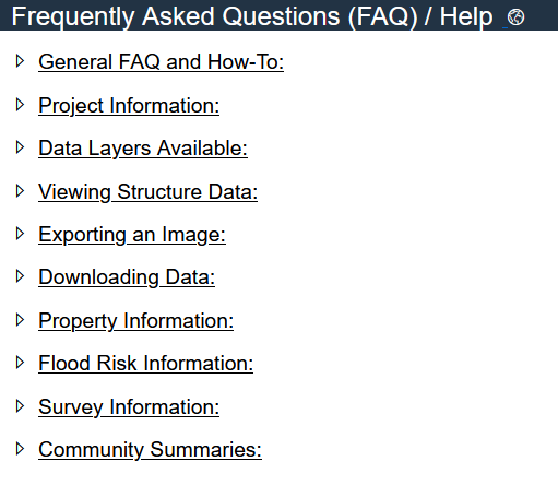
Help/FAQ Page
The Help/FAQ Page includes a variety of topics, which can be expanded or collapsed for ease in viewing.