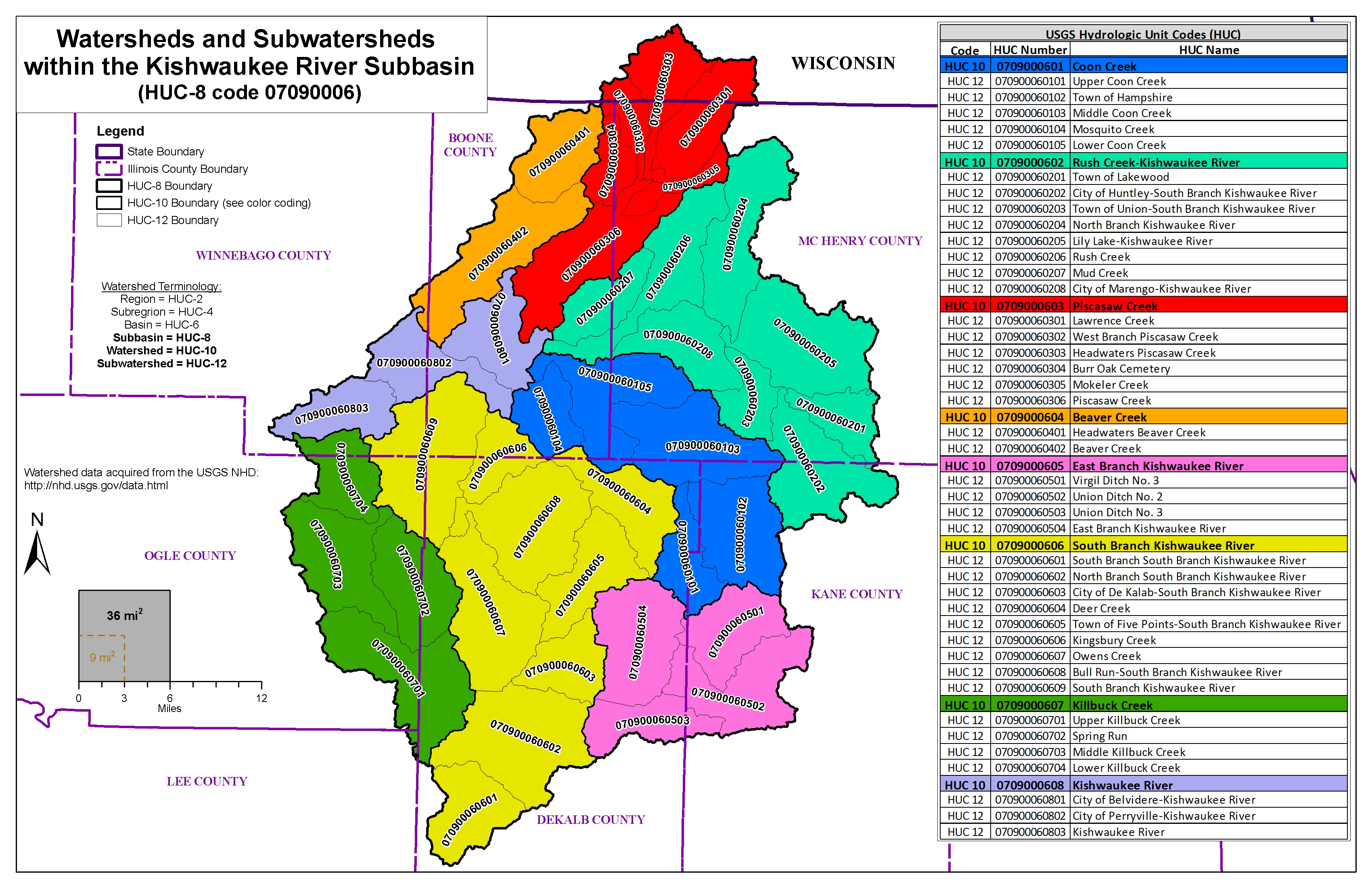
KISHWAUKEE WATERSHED (HUC 0709006)
The Kishwaukee River Watershed is located in northern Illinois and includes waterways that flow across seven counties: Winnebago, Boone, McHenry, DeKalb, Lee and Kane.
Illinois State Water Survey (ISWS) hydrologic and hydraulic modeling in Boone, DeKalb, Ogle and Winnebago Counties is underway as part of a study to help local communities identify areas of high flood risk for flood mitigation planning. ISWS is working collaboratively on the project with the Illinois Department of Natural Resources-Office of Water Resources (IDNR-OWR) and the Federal Emergency Management Agency (FEMA). The first phase of the project, data collection, began in early 2022.
Kishwaukee River Tributaries
Project Initiation Community Coordination Meeting (DeKalb, Kane, and McHenry Counties)
1/29/2026
Status Update Meeting (DeKalb, Kane, and McHenry Counties)
9/12/2024
Project Initiation Community Coordination Meeting (Boone, Winnebago, and Ogle Counties)
9/4/2024
Kishwaukee Watershed
Project Initiation Community Coordination Meeting
6/18/2022
Press Releases
Water survey to analyze flood risk in McHenry County
Jun 6, 2025
The Illinois State Water Survey is continuing data development for the Kishwaukee River watershed as part of a multiple-phase study to help local communities identify areas of high flood risk for flood mitigation planning.
The information below is for historical reference. The Discovery process for this watershed is complete and the data is considered archival.
Discovery Material, November 2018
[ Return to Watersheds Listing ]