The Upper Rock River basin is primarily located in Wisconsin while the Lower Rock is located entirely within Illinois. The length of the Rock River in Illinois is about 163 miles. The Rock River drains 10,915 sq. mi. in southeastern Wisconsin and northwestern Illinois; about 5317 sq. mi. are in IL (Knapp and Russell, 2004).
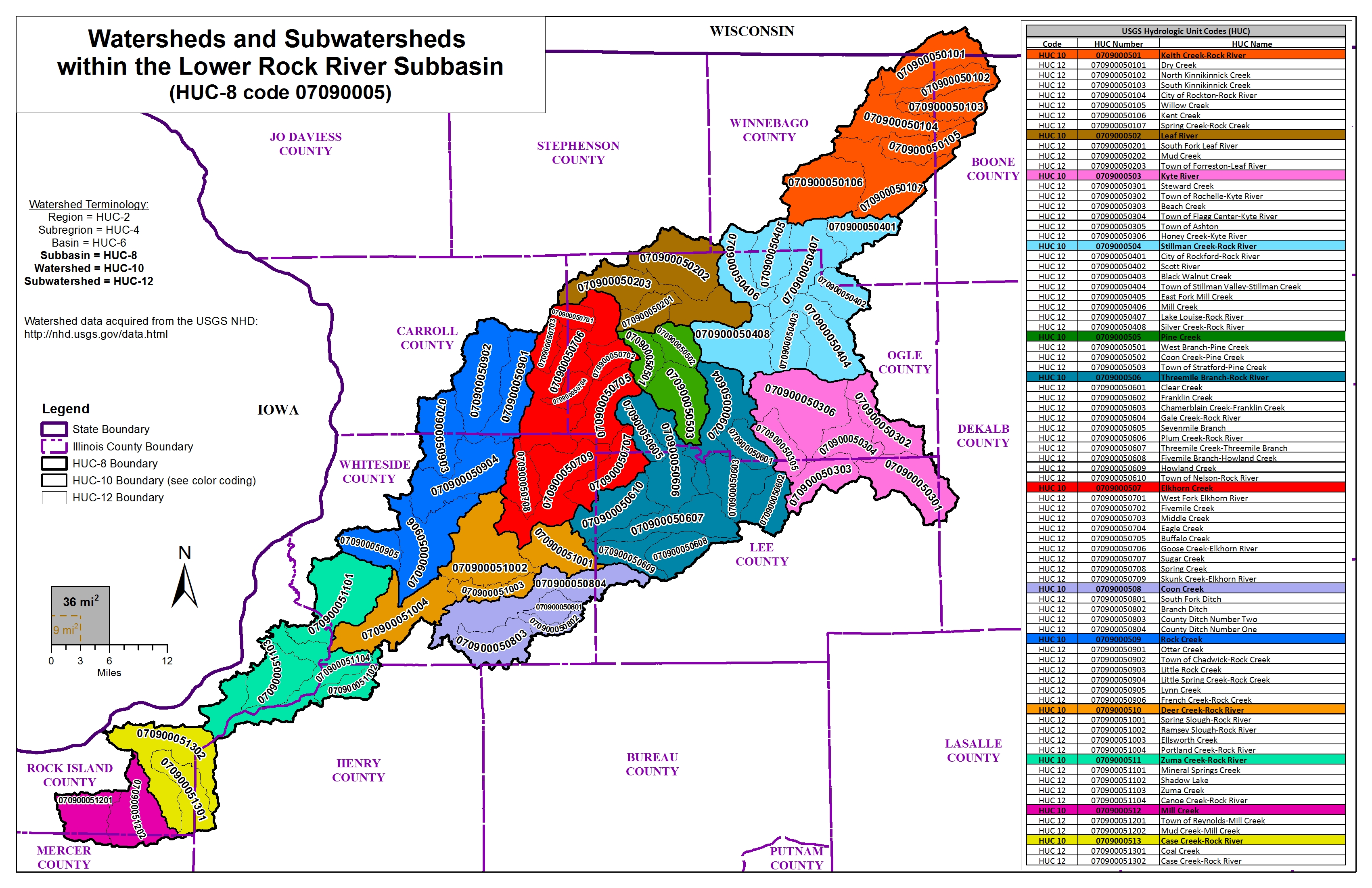
LOWER ROCK RIVER WATERSHED (HUC 07090005)
The Lower Rock River watershed includes parts of Boone, Carroll, Henry, Lee, Mercer, Ogle, Rock Island, Stephenson, Whiteside, and Winnebago Counties in Illinois.
Rock River Tributaries, Leveed areas: Rock Island County
Project Initiation Coordination Call
10/31/2022
Meeting Recording (hosted on Illinois Media Space)
Meeting Presentation (PDF)
Rock River and Tributaries: Rock Island, Henry, and Whiteside Counties
Flood Risk Review Meeting
6/8/2021 & 6/10/2021
- June 8, 2021:
Main Meeting Recording (hosted on Illinois Media Space)
Floodway Breakout Session Recording (hosted on Illinois Media Space)
Levee Breakout Session Recording (hosted on Illinois Media Space)
- June 10, 2021:
Main Meeting Recording (hosted on Illinois Media Space)
Floodway Breakout Session Recording (hosted on Illinois Media Space)
Levee Breakout Session Recording (hosted on Illinois Media Space)
Meeting Presentation (PDF)
Website List Handout (PDF)
The information below is for historical reference. The Discovery process for this watershed is complete and the data is considered archival.
Lower Rock Watershed Discovery, June 2011
Winnebago County Discovery, January 2011
Discovery Report for Lower Rock Watershed in Winnebago County (PDF)
Discovery Map for Lower Rock Watershed in Winnebago County (PDF)
Lower Rock Watershed in Winnebago County Discovery Database (ZIP)
Discovery Map Data Layers of Rock River Watershed in Winnebago County (PDF)

