Finding Unpublished BFEs in FIRM Database Using Open–Source GIS
This 25–minute video tutorial demonstrates four tasks; how to determine if a mapped Zone A floodplain is model–backed, how to download a FIRM database, how to view data in the FIRM database using open–source GIS software, and how to view unpublished Base Flood Elevations (BFEs) in the FIRM database.
Overview of Application Requirements for a Letter of Map Revision (LOMR)
This 11–minute video provides a high-level overview of the application requirements for a Letter of Map Revision (LOMR). This video is ideal for engineers who are preparing to make their first LOMR application as well as experienced engineers who want to brush up on the basics.
Illinois Flood Maps: Resources By County
This 6–minute video is an overview of what can be found in the Resources By County section of the Illinois Flood Maps website.
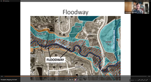
Floodplain Mapping 101
An introductory course in floodplain management and floodplain mapping, intended for community officials. This is a high level, informative session to help users better understand some of the more technical aspects of floodplain mapping.
Part 1 (36 min): Covers basic terms, types of FEMA maps, flood zones, Flood Insurance Studies (FIS), and locating Base Flood Elevations (BFEs) on maps and exhibits.
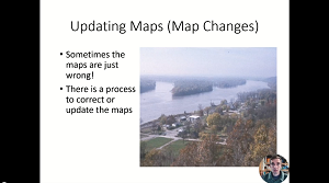
Part 2 (16 min): Updating maps through map changes, brief discussion of levees