McDonough County Flood Hazard Information
Effective Regulatory Products
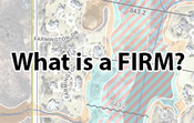
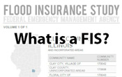
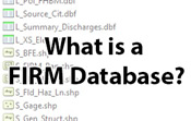
Effective products are the official regulatory products as adopted by FEMA and a given local community for the National Flood Insurance Program (NFIP). The products are intended to be used as the basis for official actions required by the NFIP. The products may include Flood Insurance Rate Maps (FIRM), Flood Insurance Study (FIS) reports, FIRM Databases, and effective Letters of Map Change (LOMC).
Effective Flood Insurance Rate Maps for McDonough County may be viewed and/or downloaded at the FEMA Flood Map Service Center (MSC).
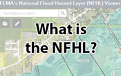
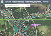 Additionally, effective flood hazard data can be viewed in FEMA's National Flood Hazard Layer viewer (NFHL). Counties with a status of Effective or any of the Physical Map Revision (PMR) statuses (symbolized with diagonal lines) on the Resources by County map are included in the NFHL viewer. Zoom to an area or use the search bar to find a specific location. Full FIRM panels or a “FIRMette” of a smaller area can be exported using the NFHL Print Tool.
Non-regulatory Products
Non-regulatory products, referred to as Flood Risk Products (FRP), go beyond the basic flood hazard information found in the official regulatory products. The Flood Risk Database, which parallels the FIRM database, provides a wealth of data that may be used to analyze, communicate, and visualize flood risk. Communities are encouraged to use this database to support mitigation efforts and raise awareness. Non-Regulatory products such as Flood Risk Databases are also available at the MSC.
Mapping Phase
Preliminary Map Products
Released 11/4/2024, Preliminary products are available below, or at higher resolution from the FEMA MSC:
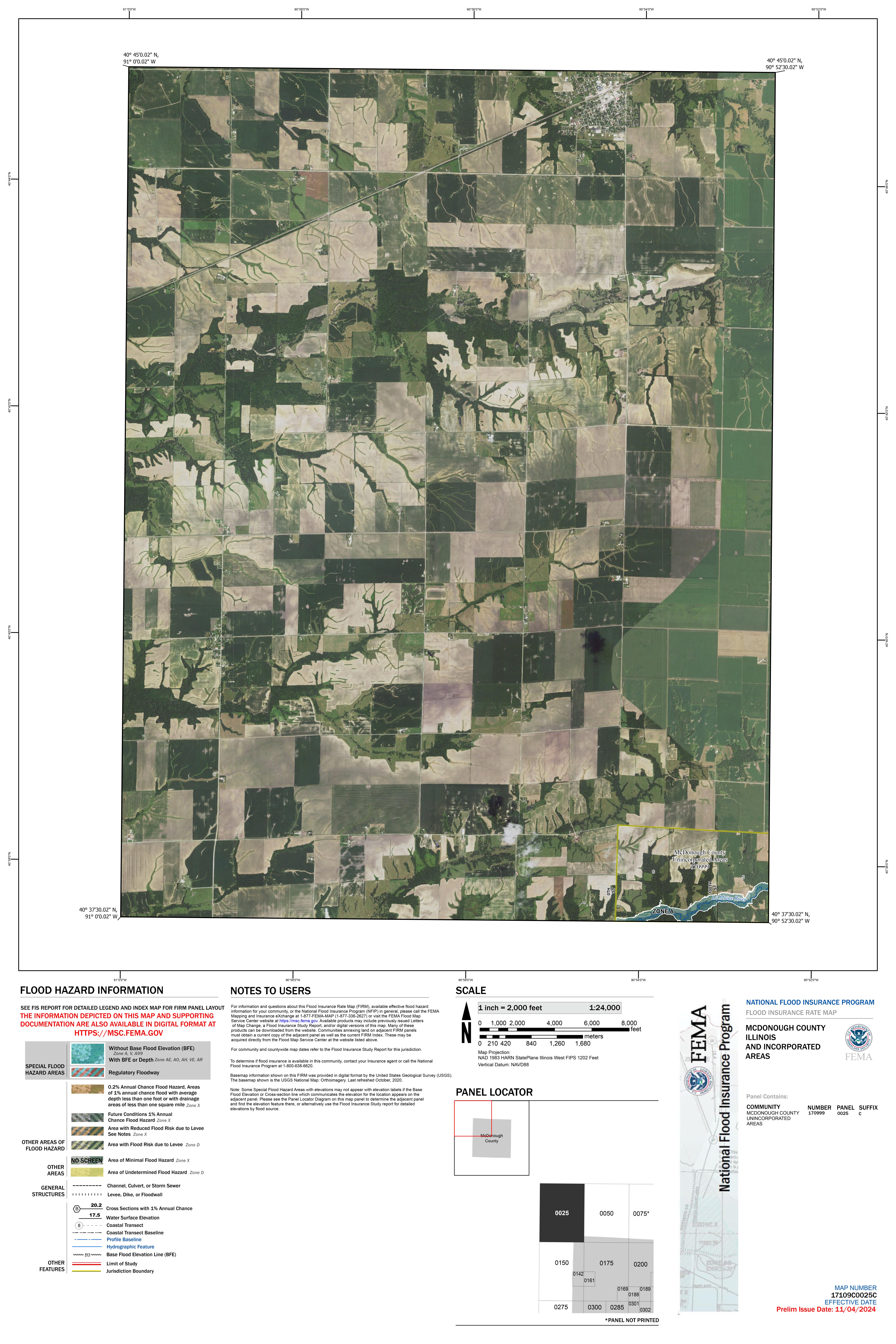
17109C0025C
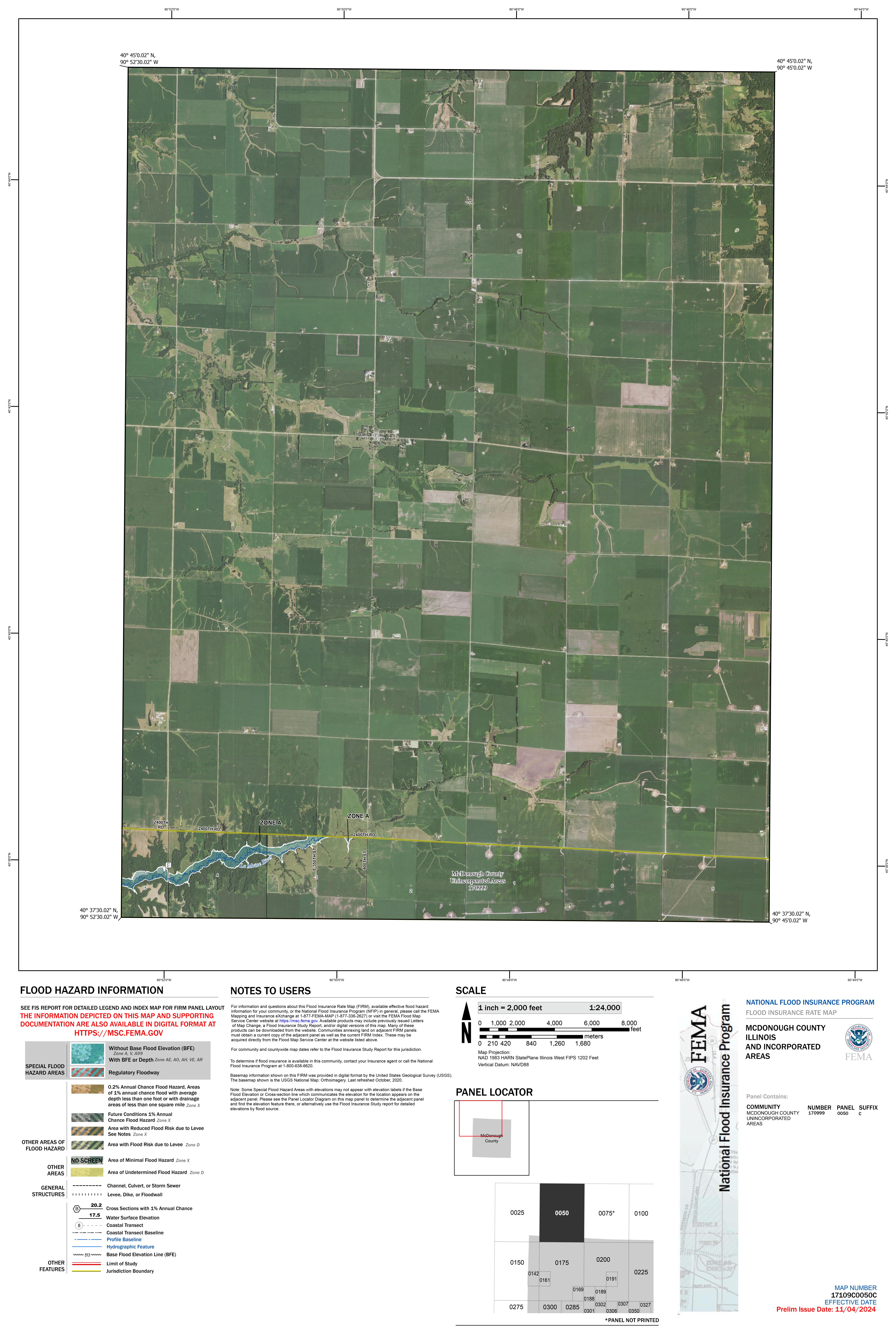
17109C0050C
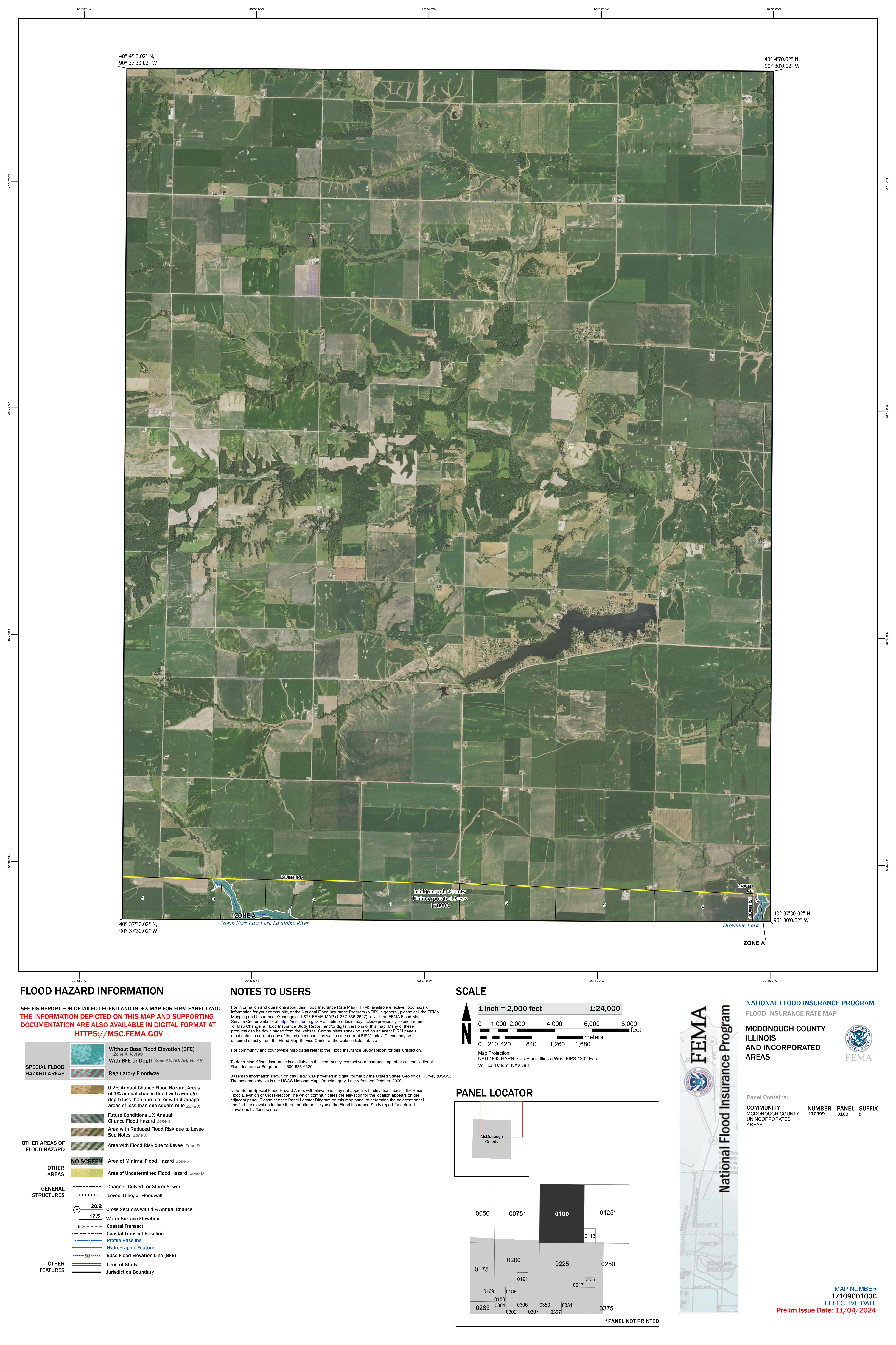
17109C0100C
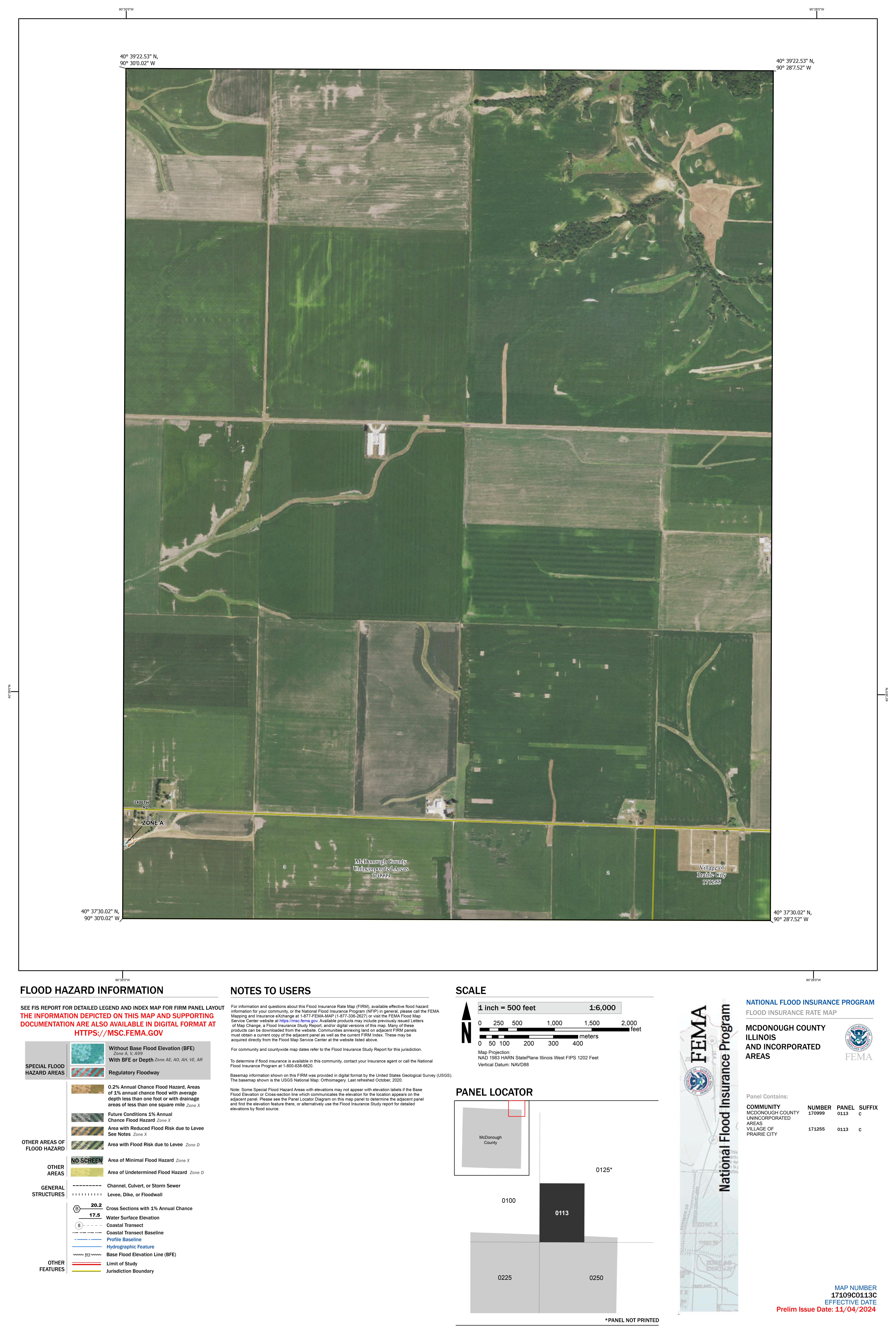
17109C0113C
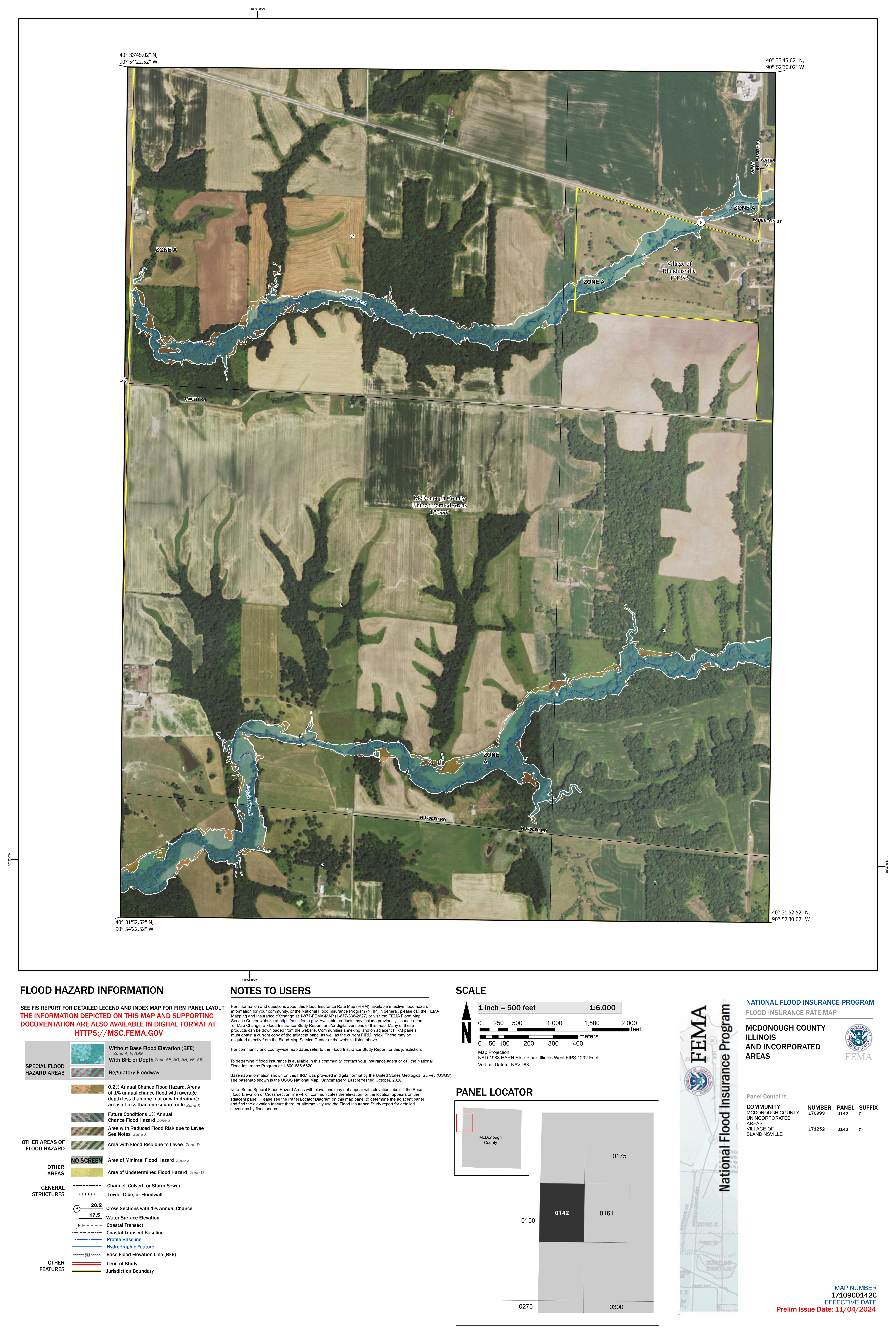
17109C0142C
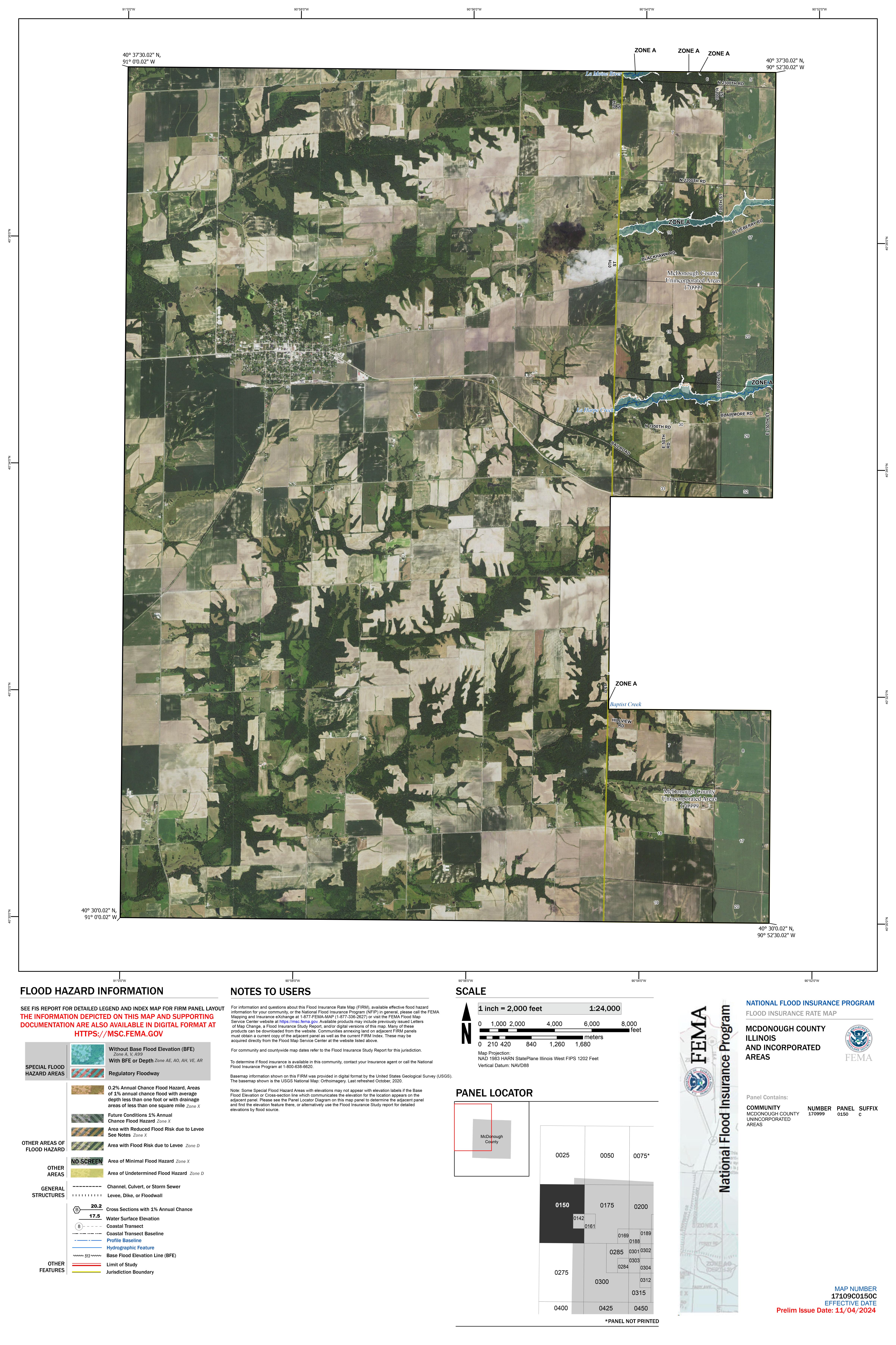
17109C0150C
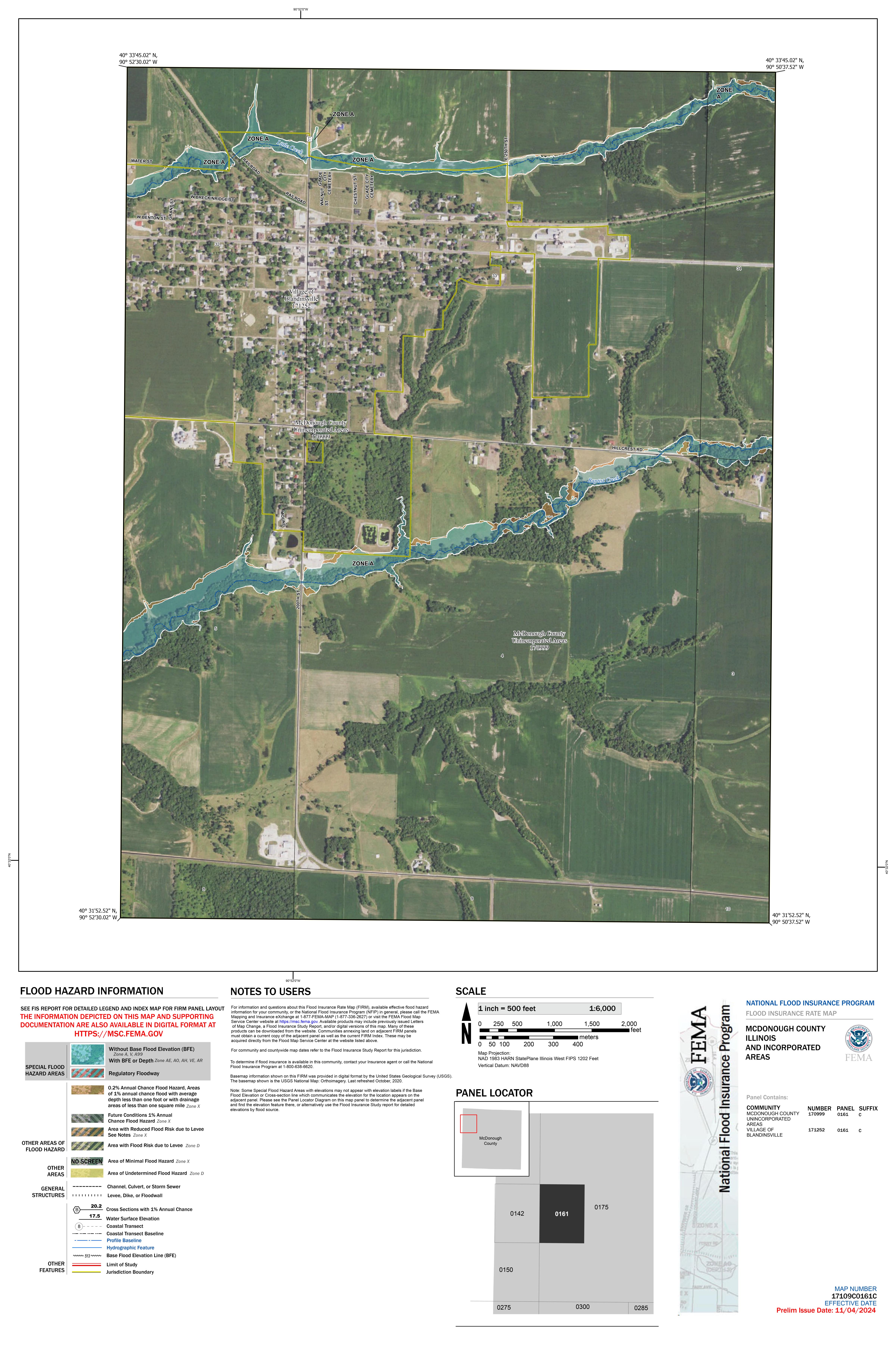
17109C0161C
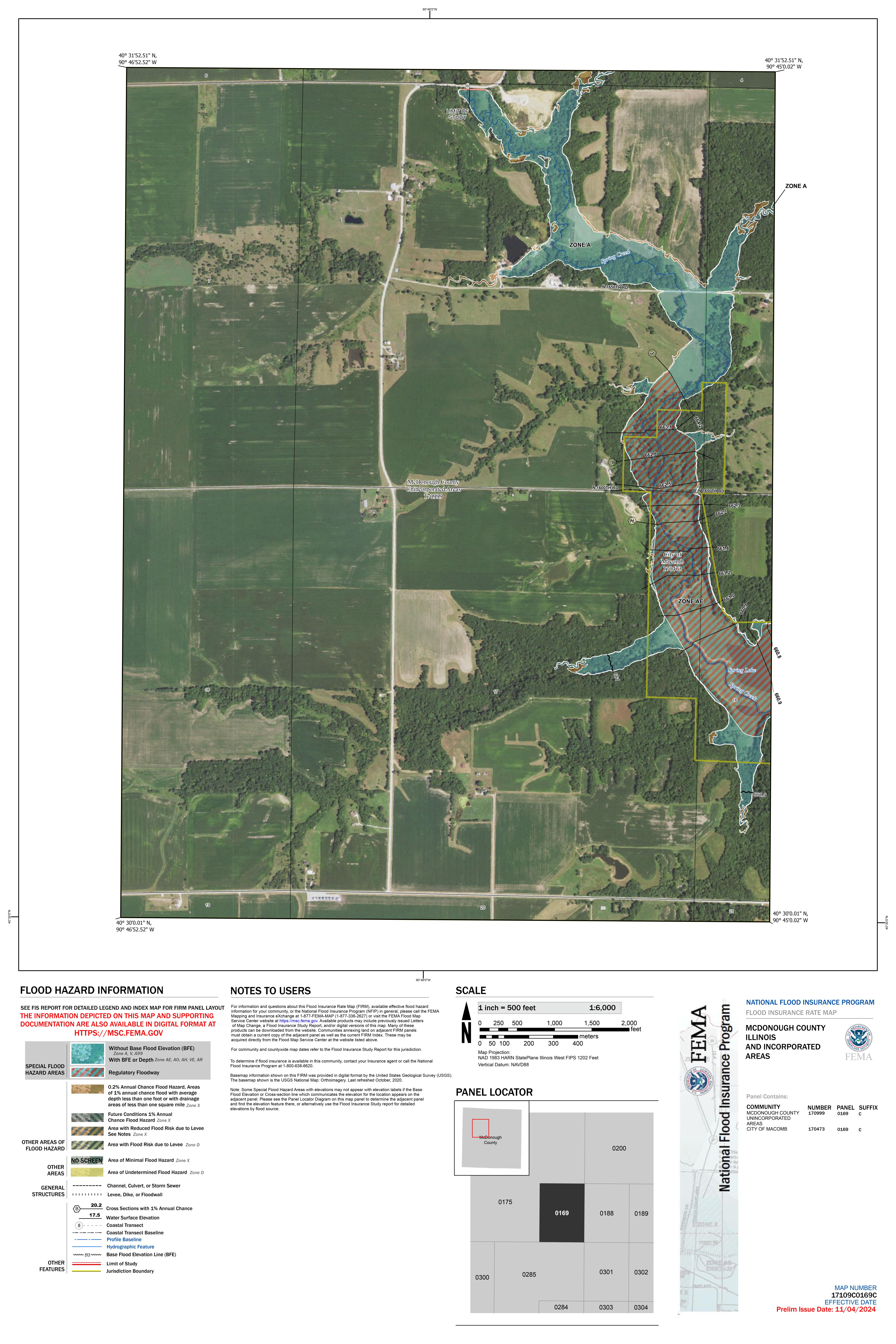
17109C0169C
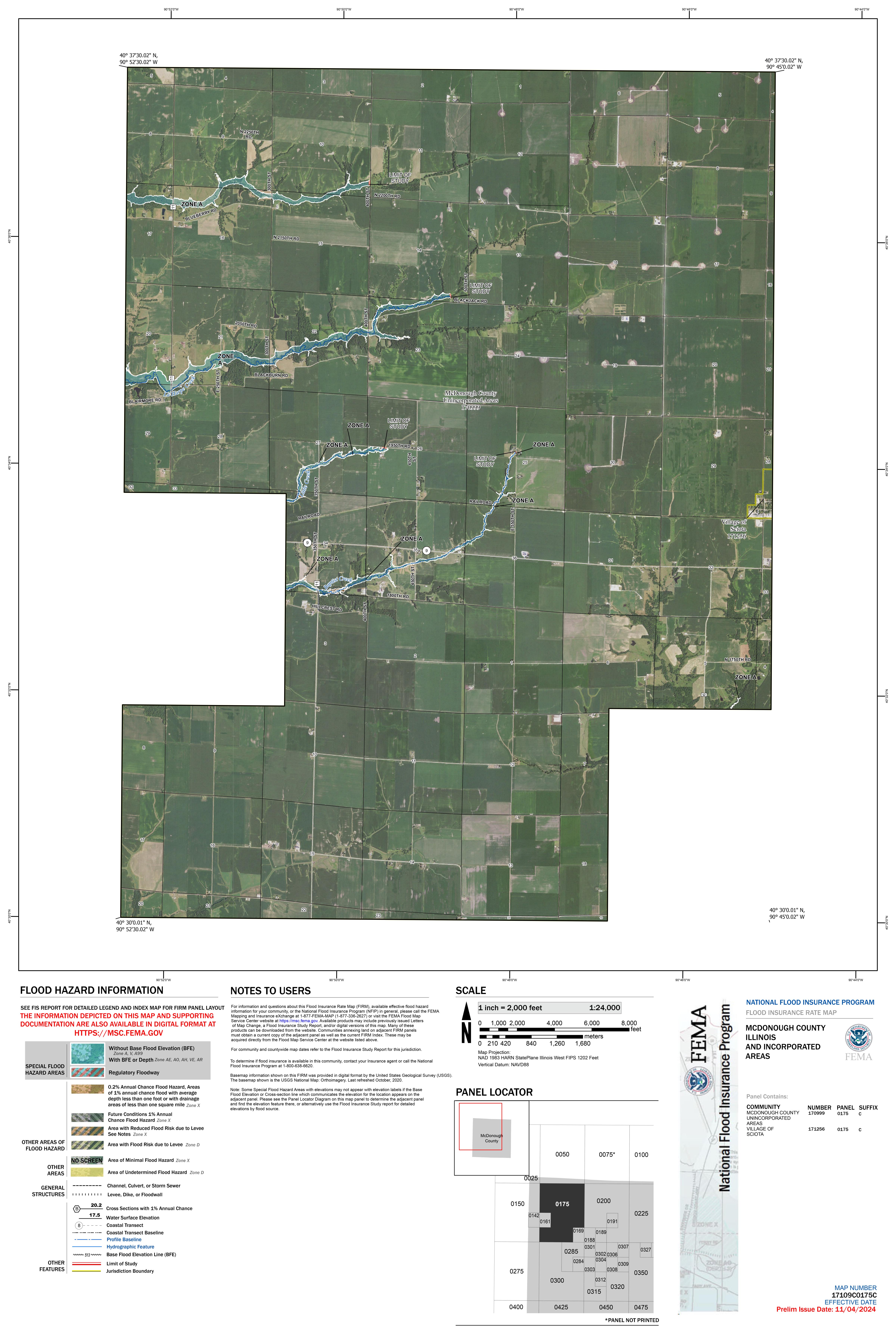
17109C0175C
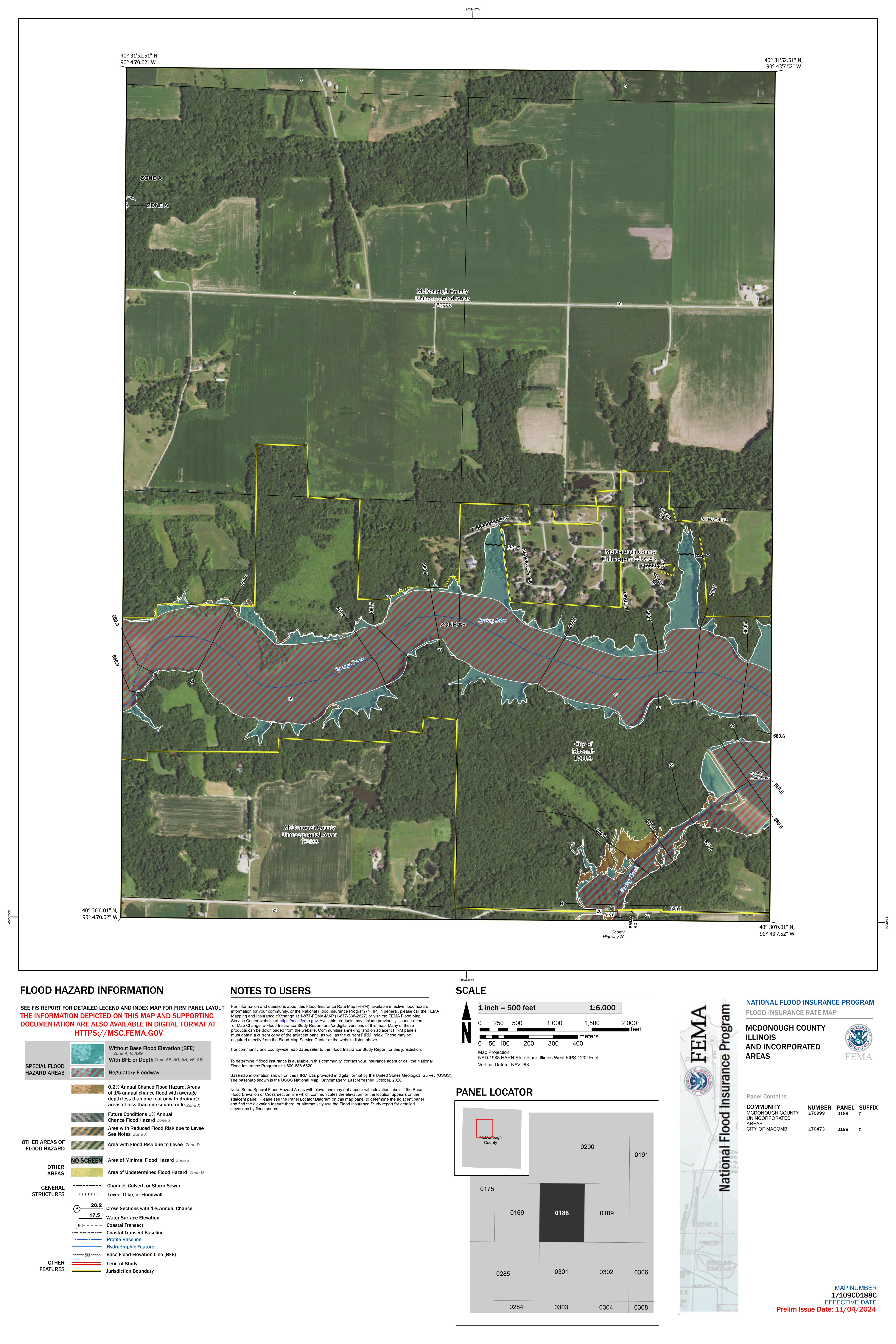
17109C0188C
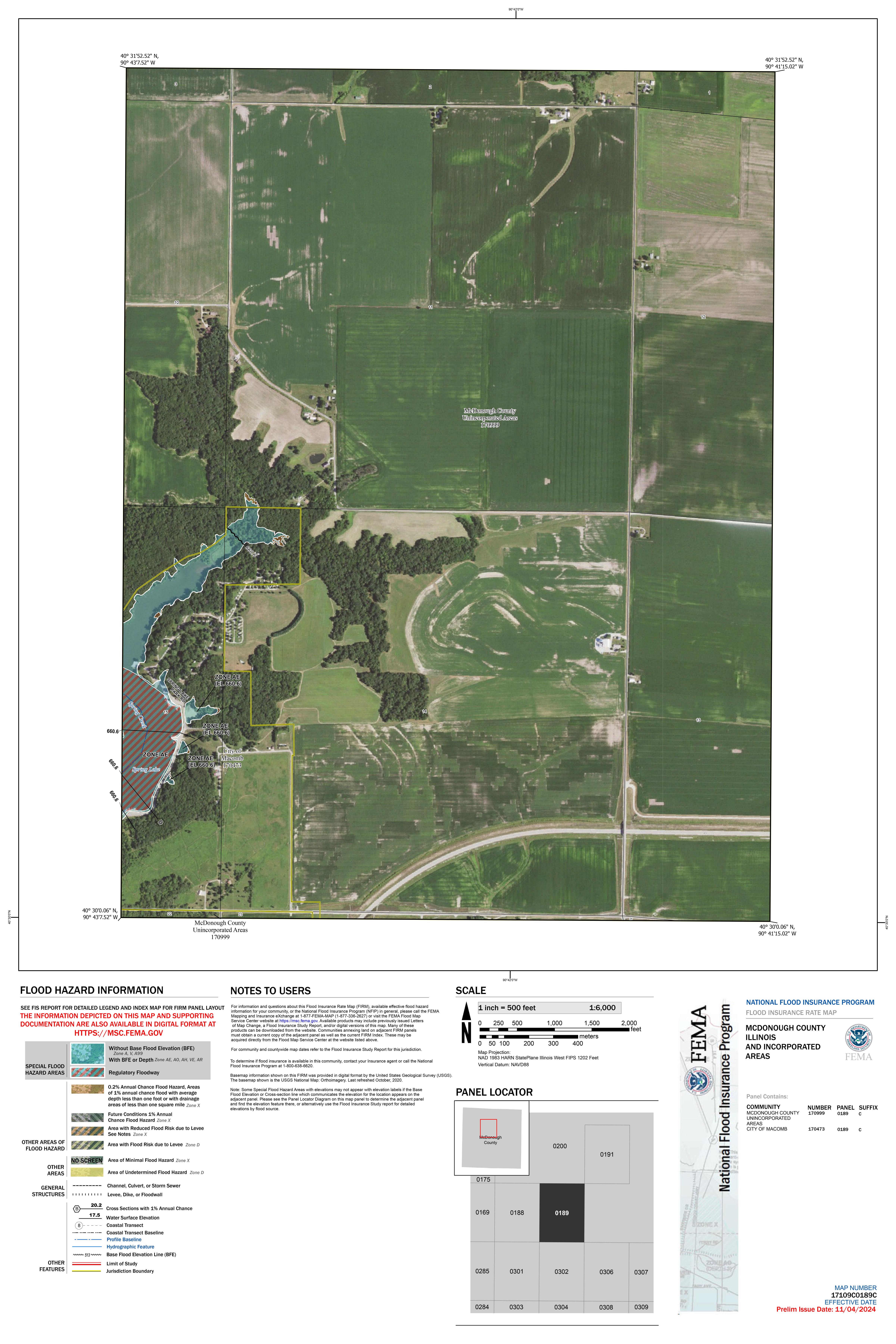
17109C0189C
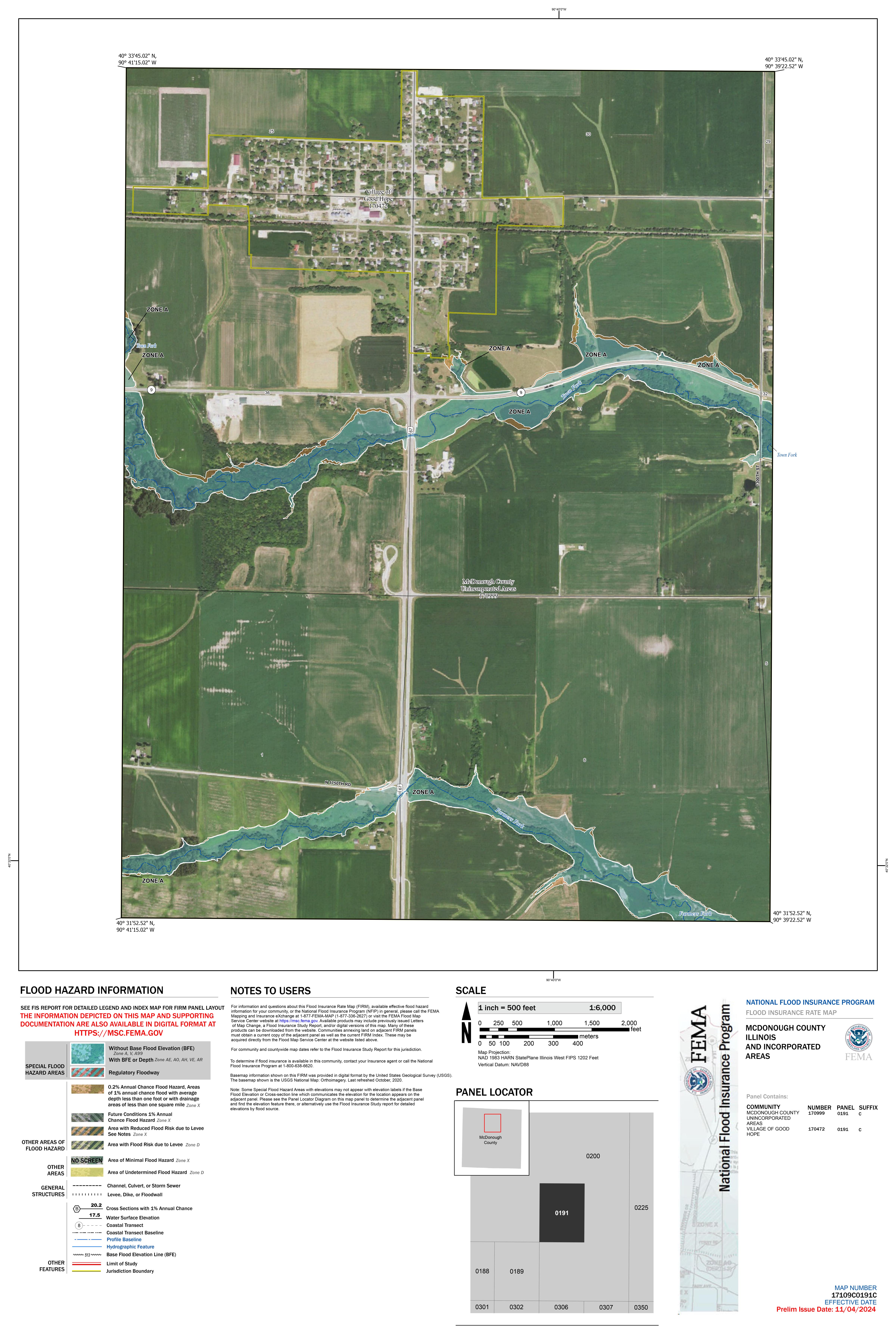
17109C0191C
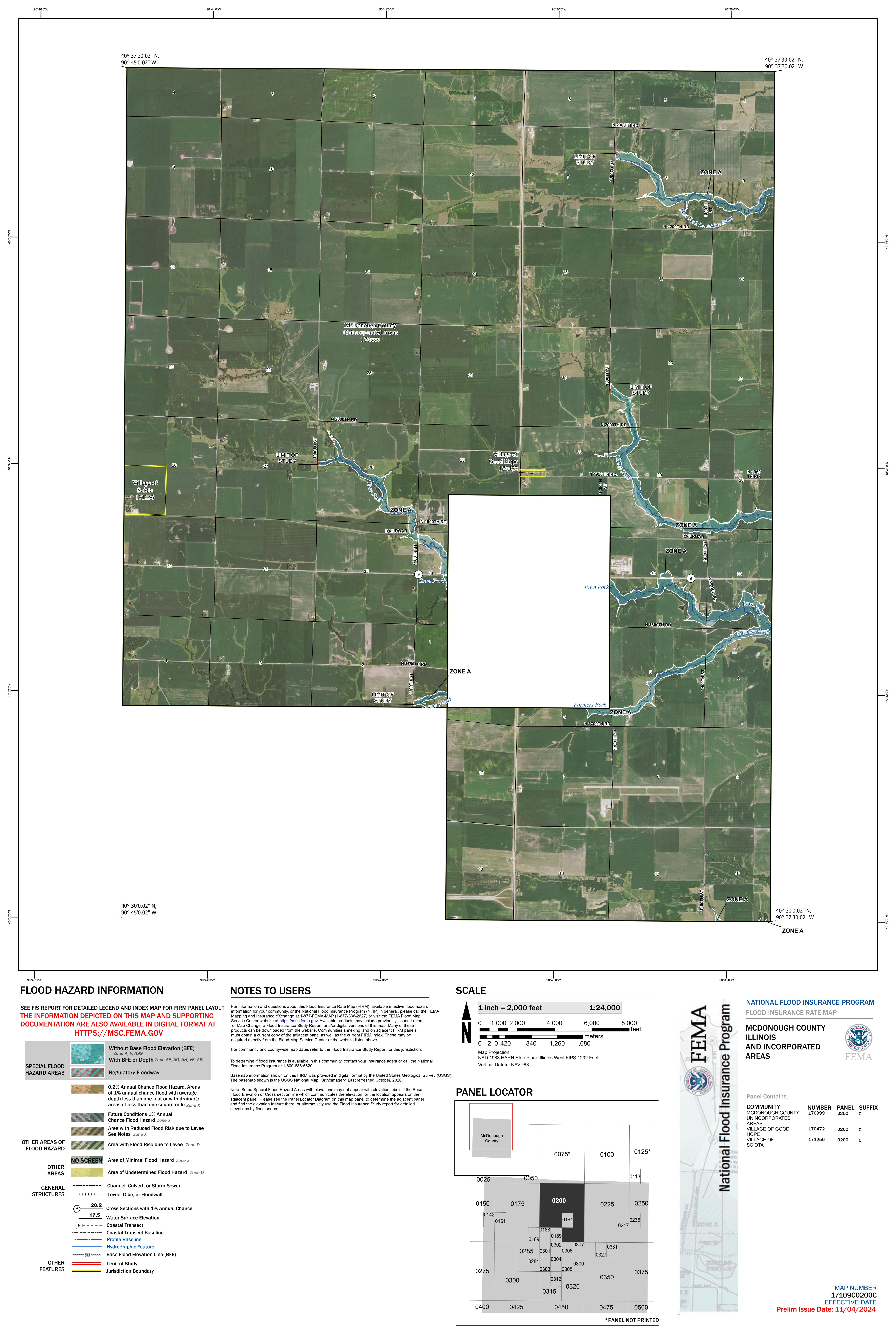
17109C0200C
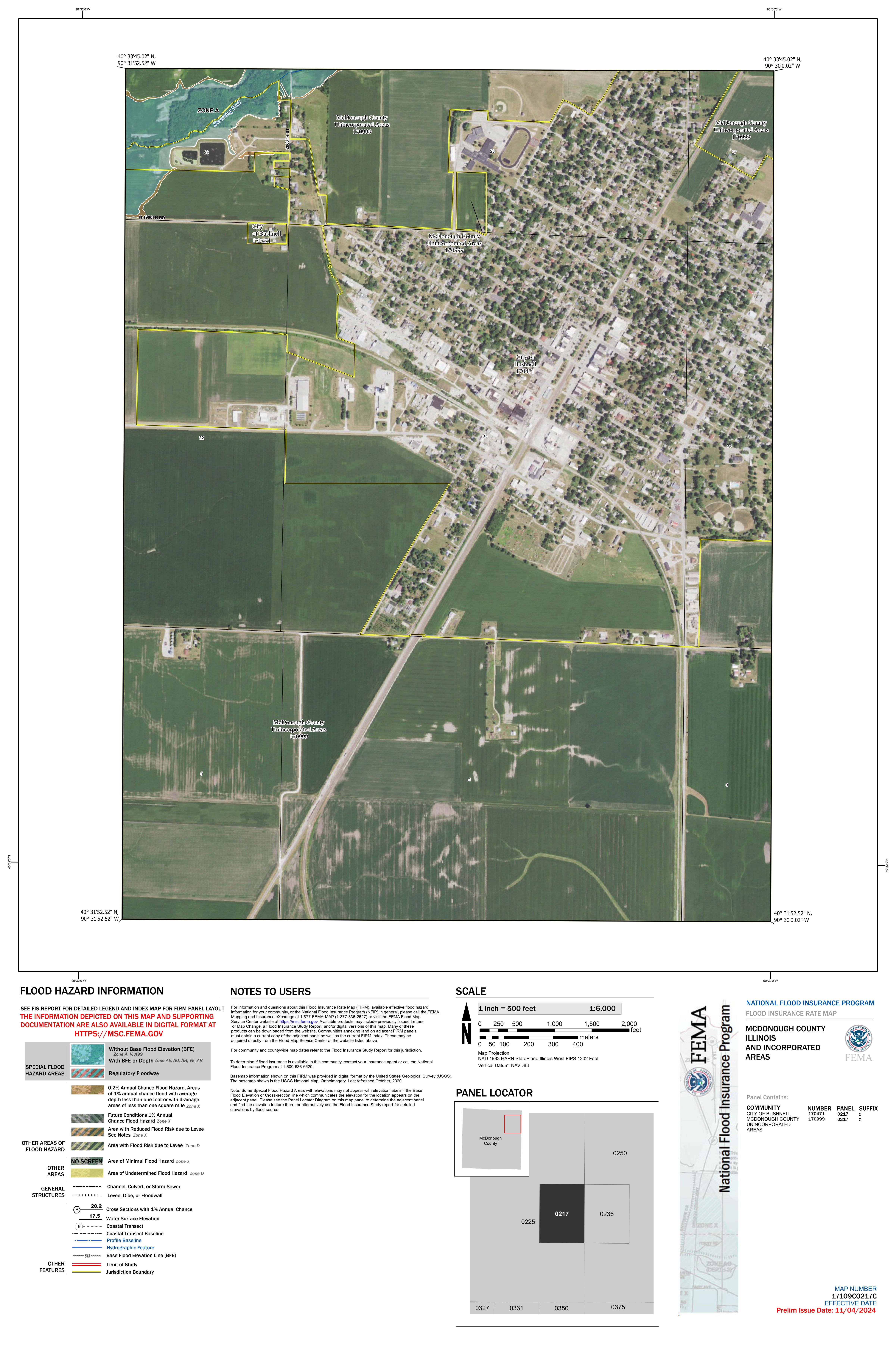
17109C0217C
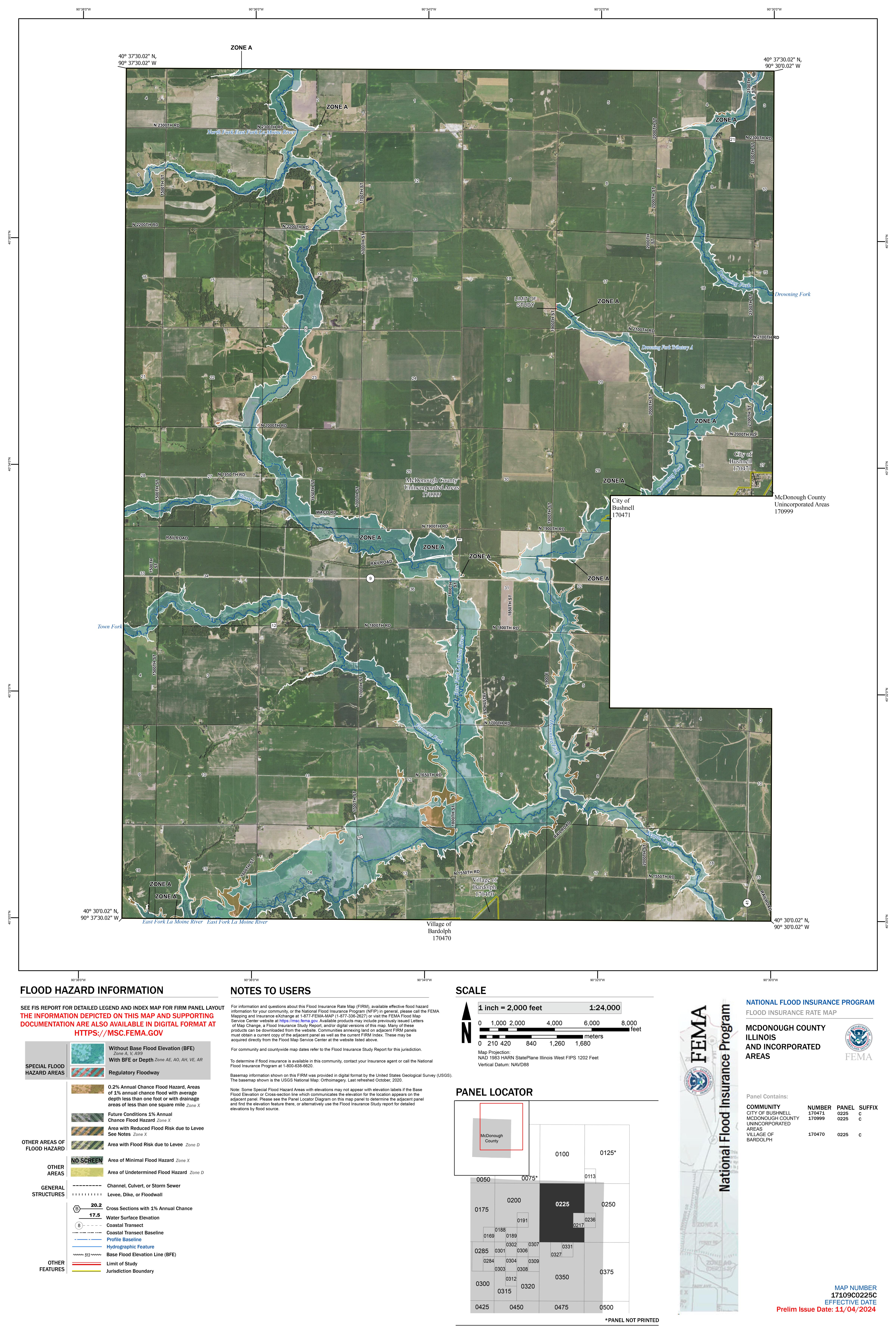
17109C0225C
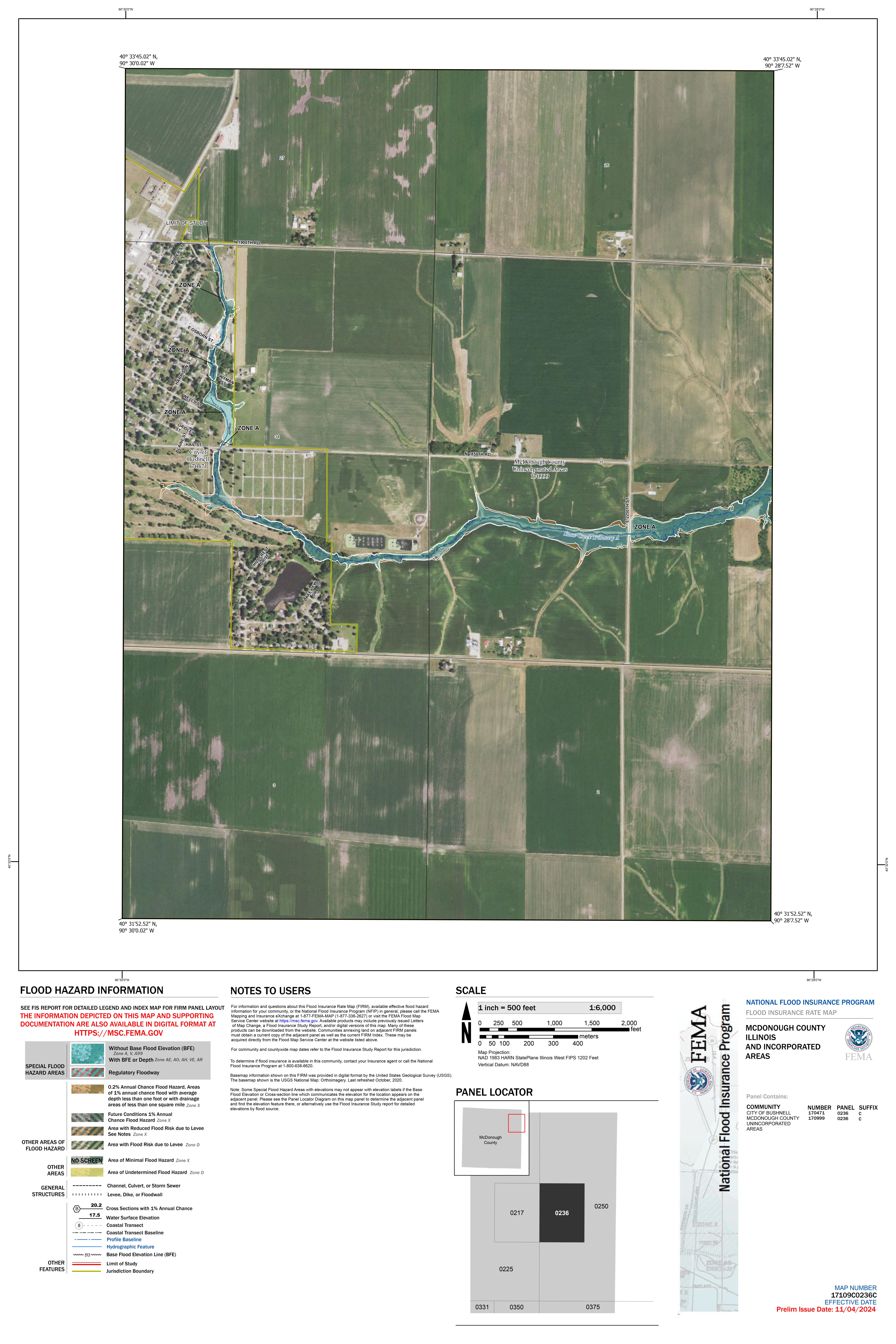
17109C0236C
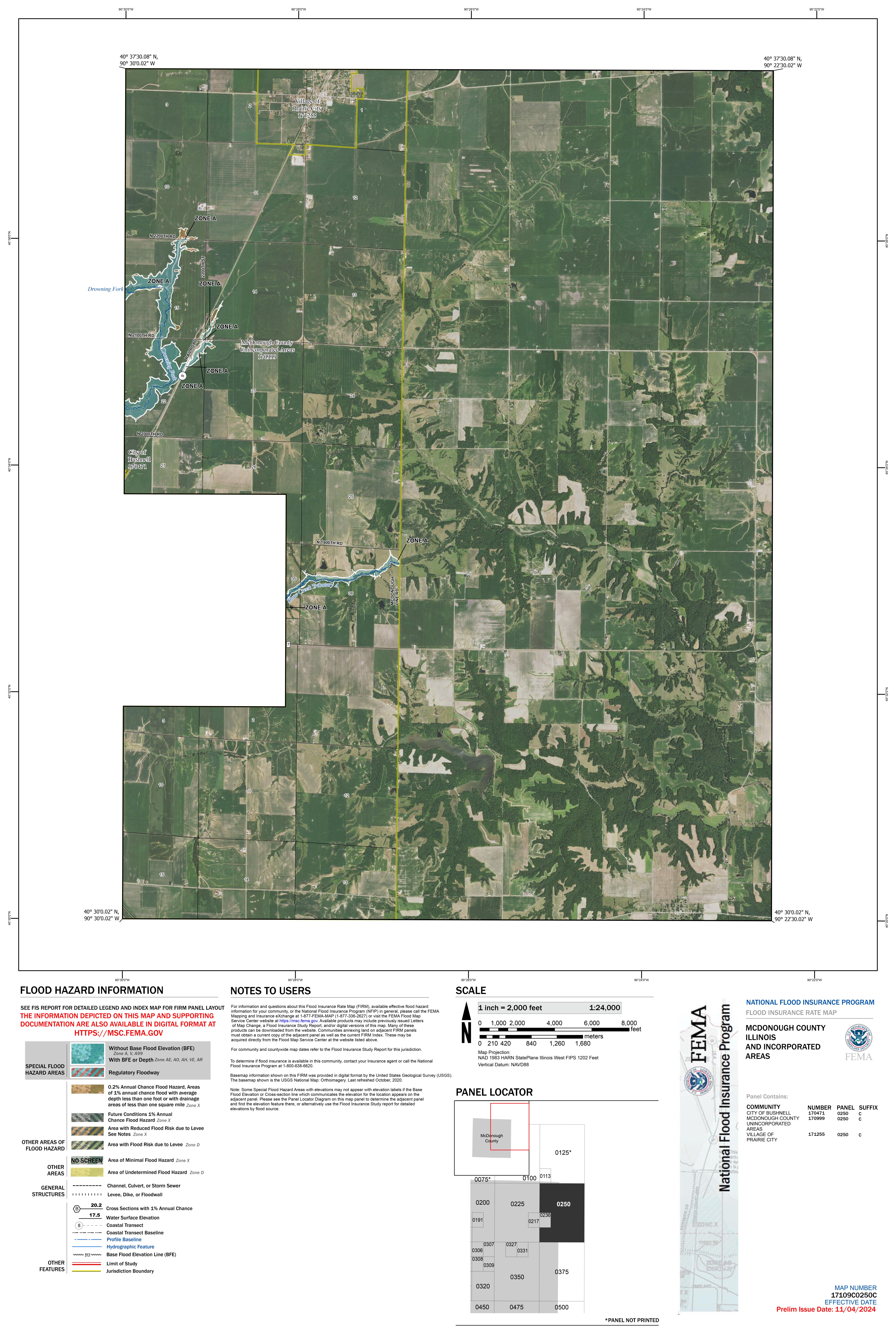
17109C0250C
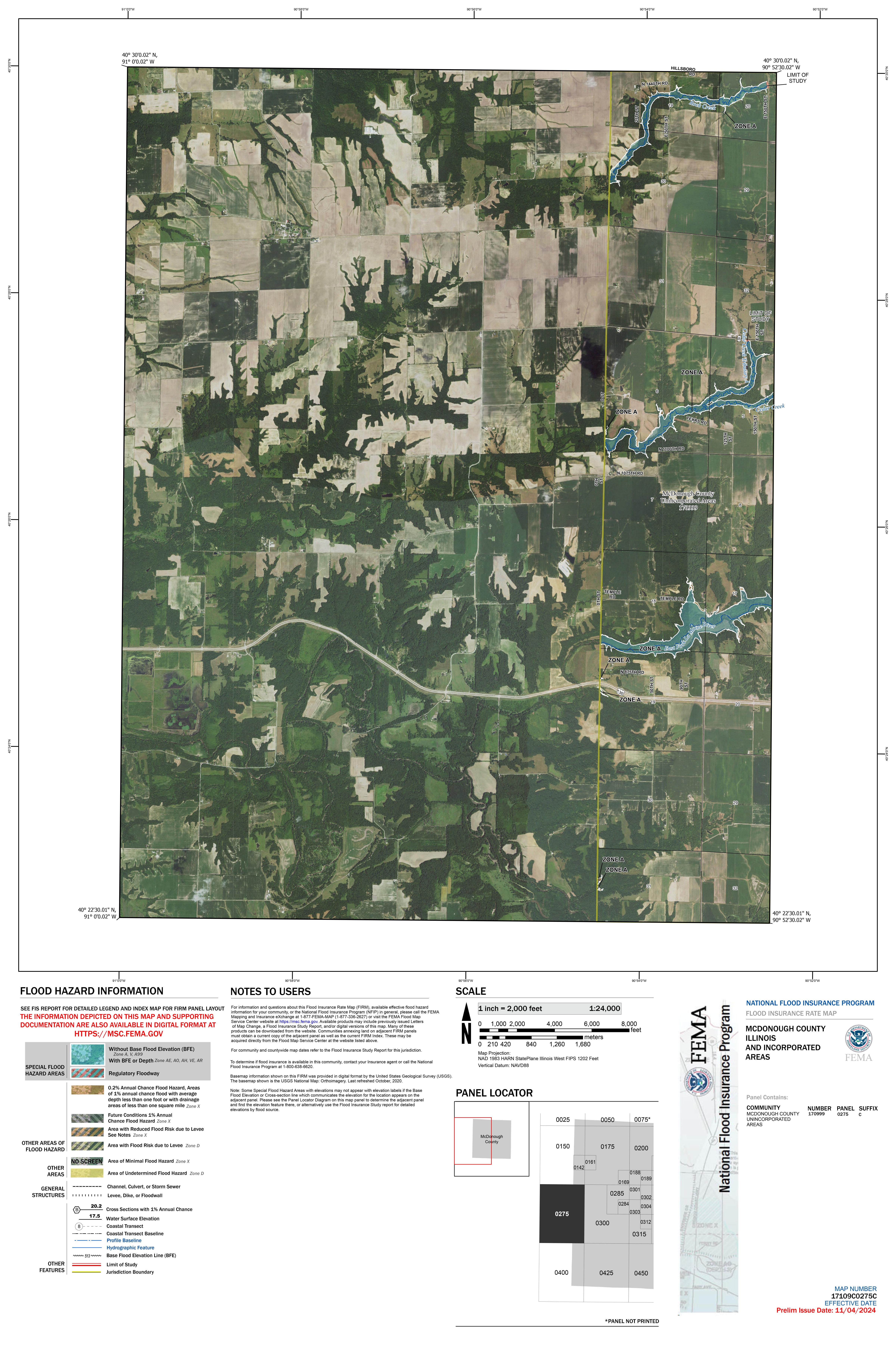
17109C0275C
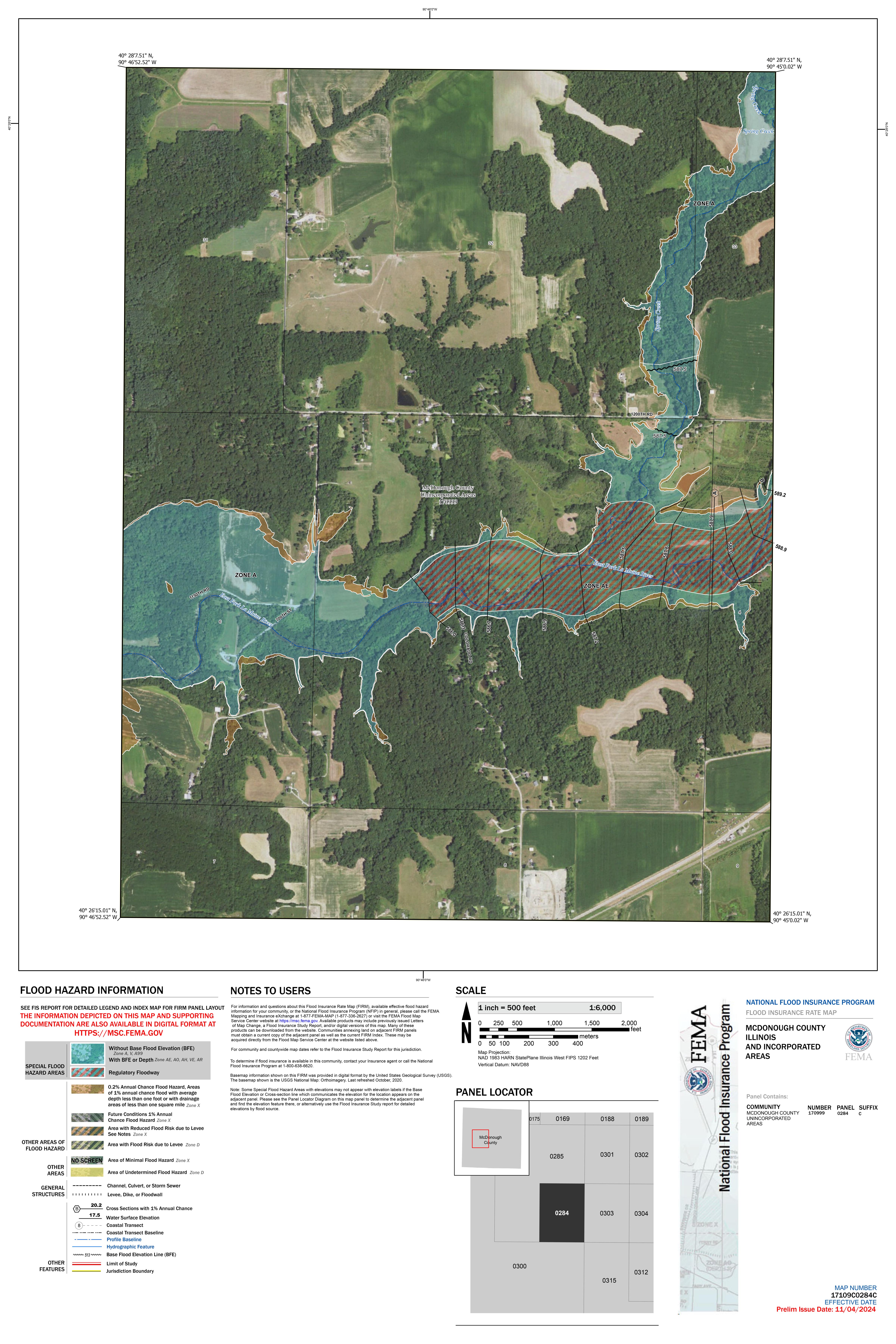
17109C0284C
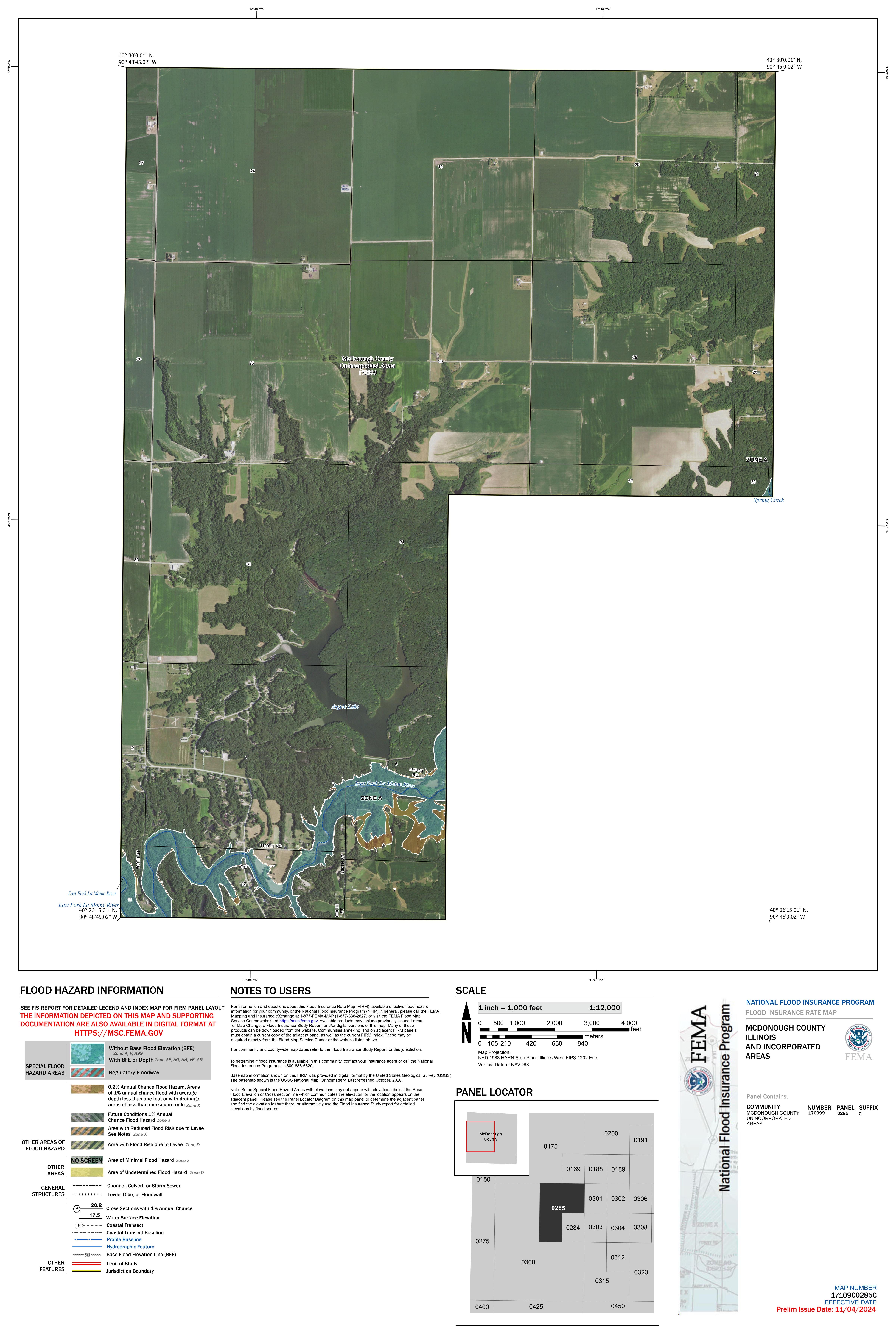
17109C0285C
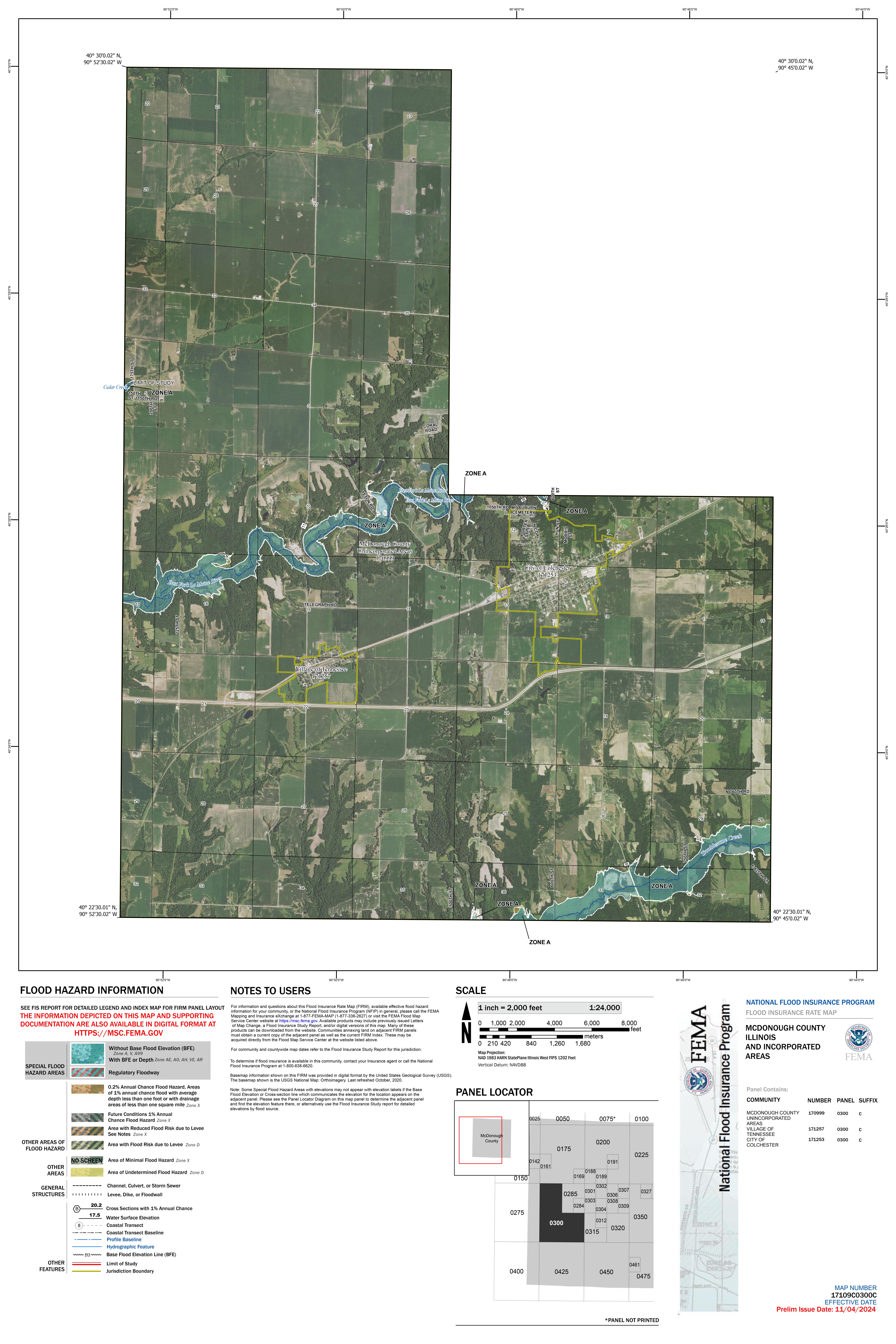
17109C0300C
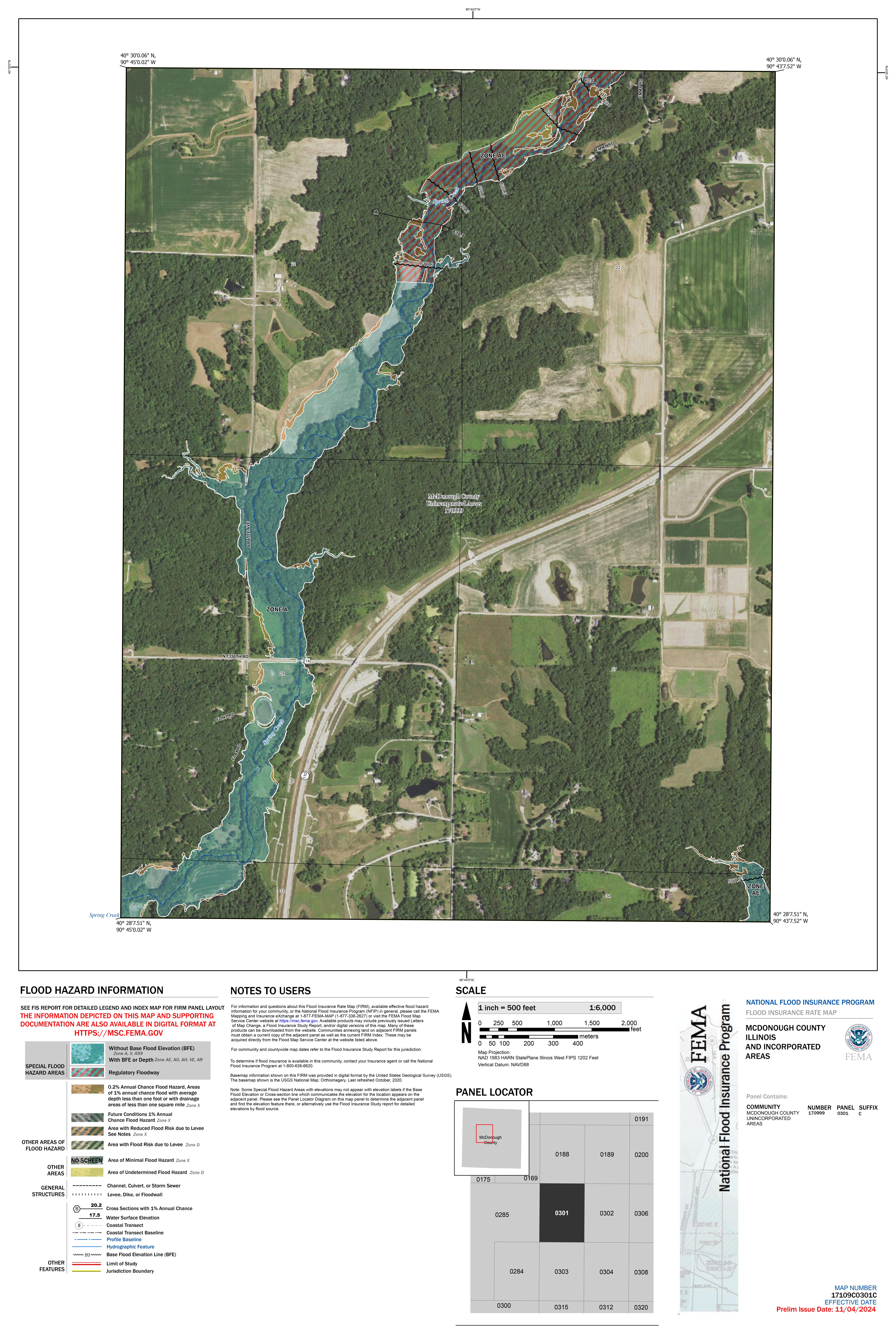
17109C0301C
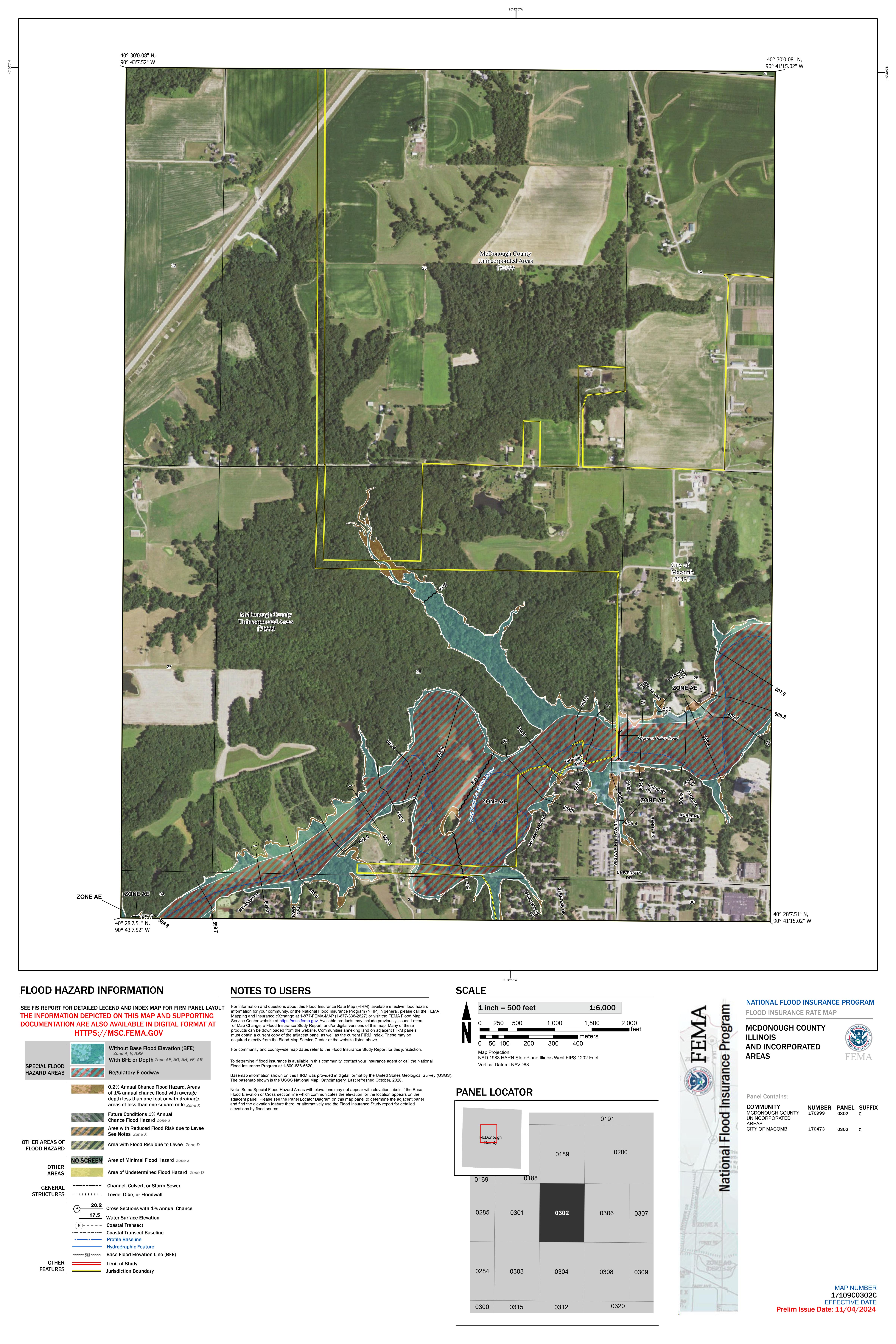
17109C0302C
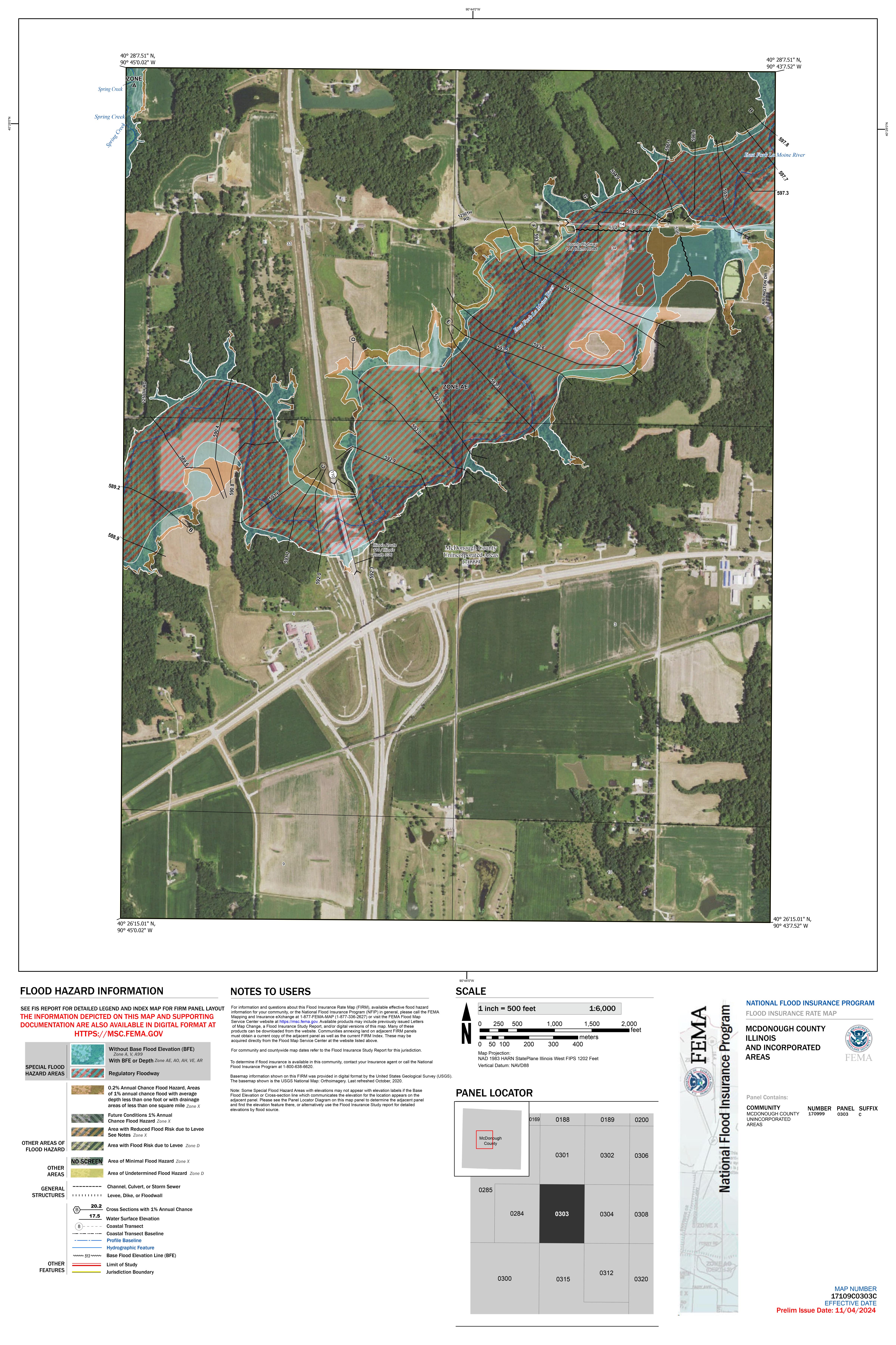
17109C0303C
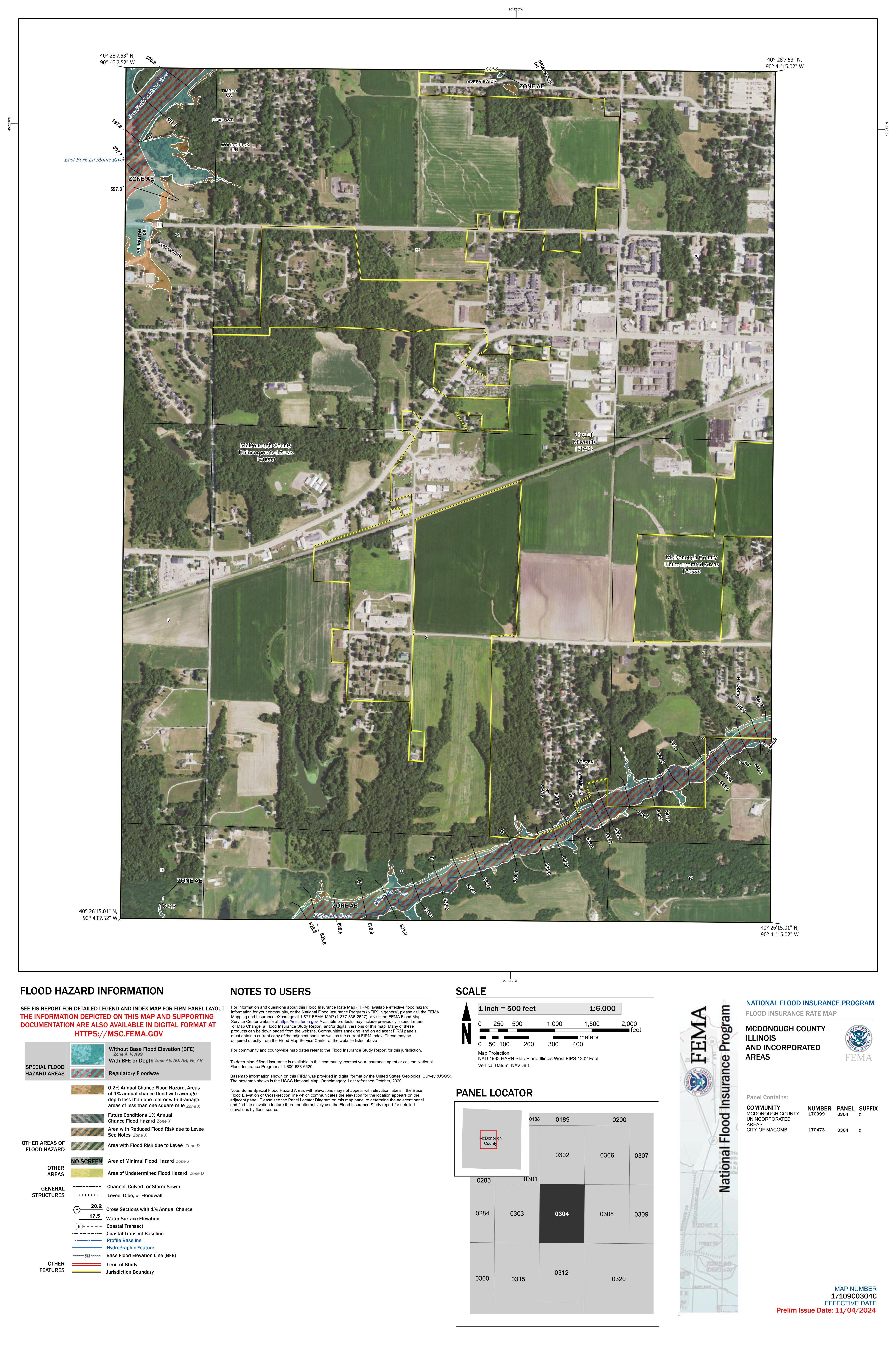
17109C0304C
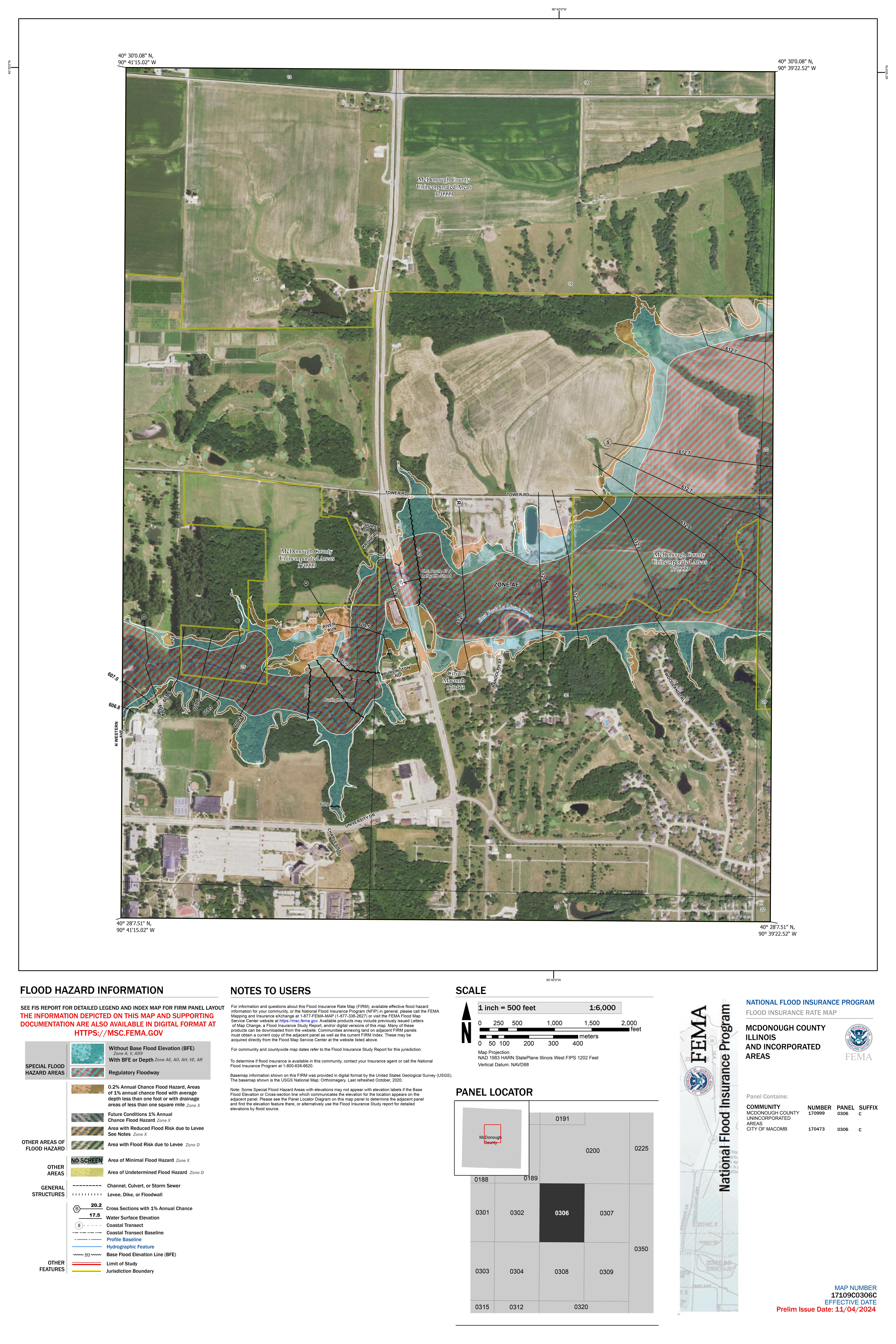
17109C0306C
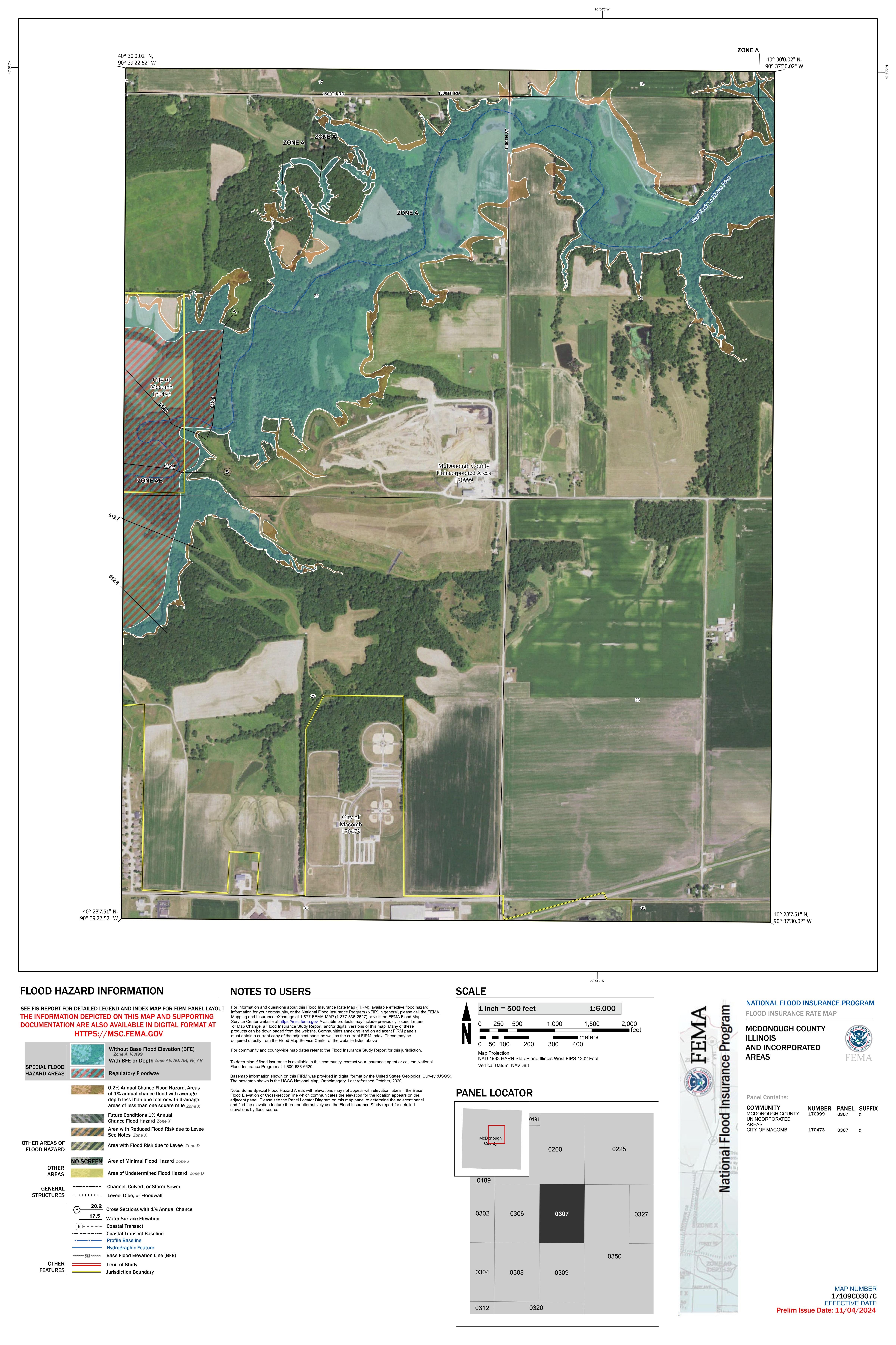
17109C0307C
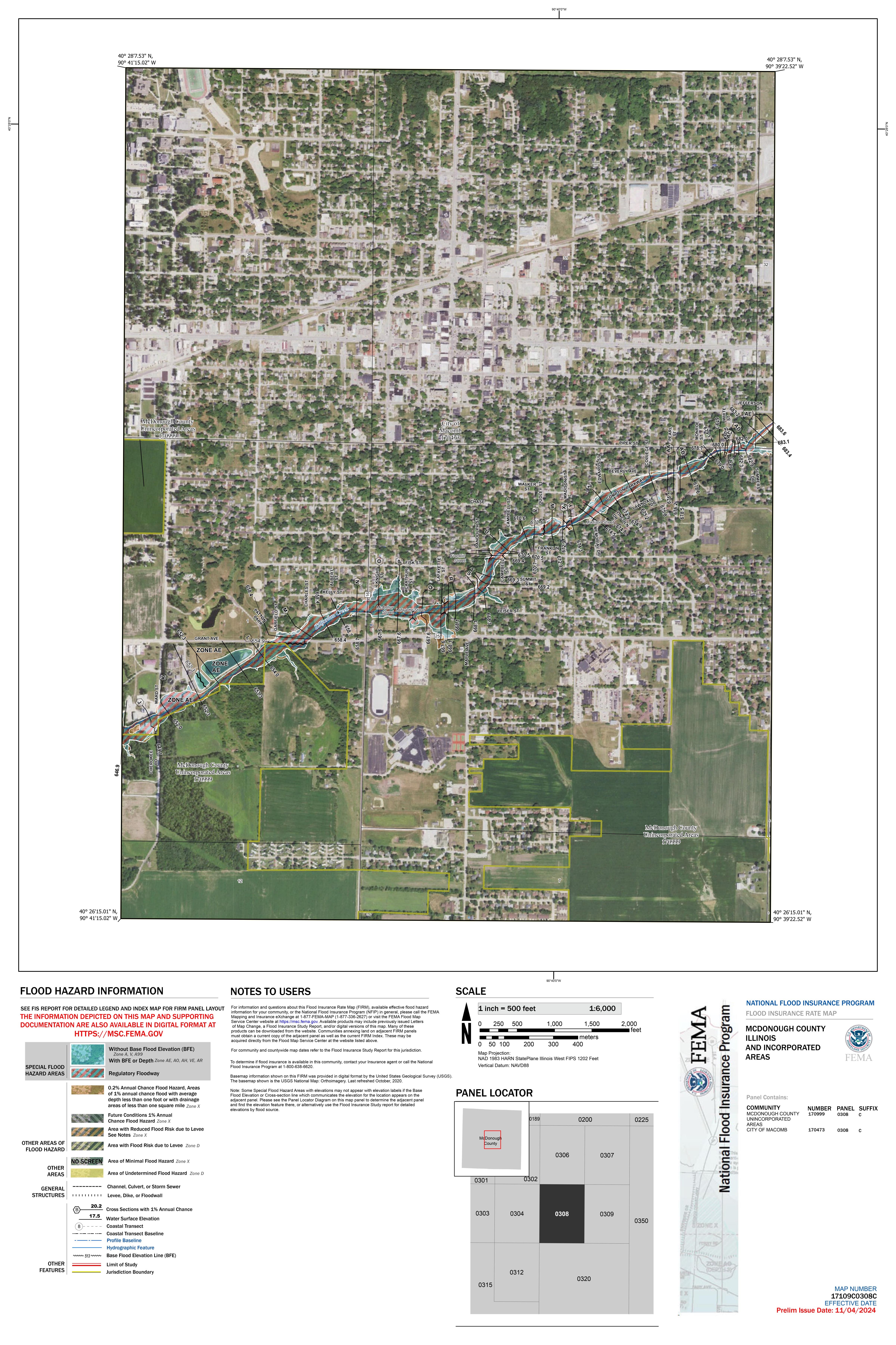
17109C0308C
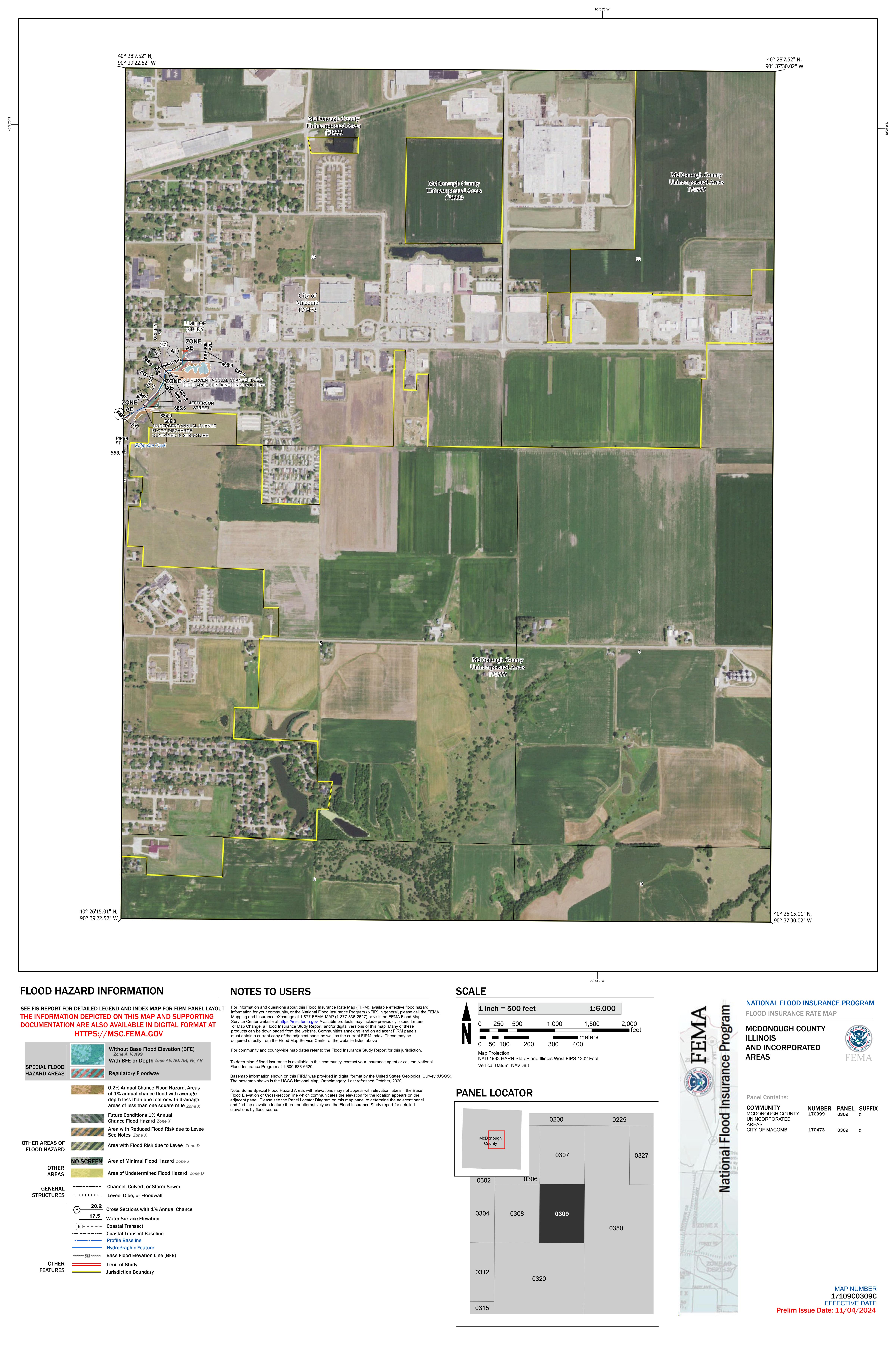
17109C0309C
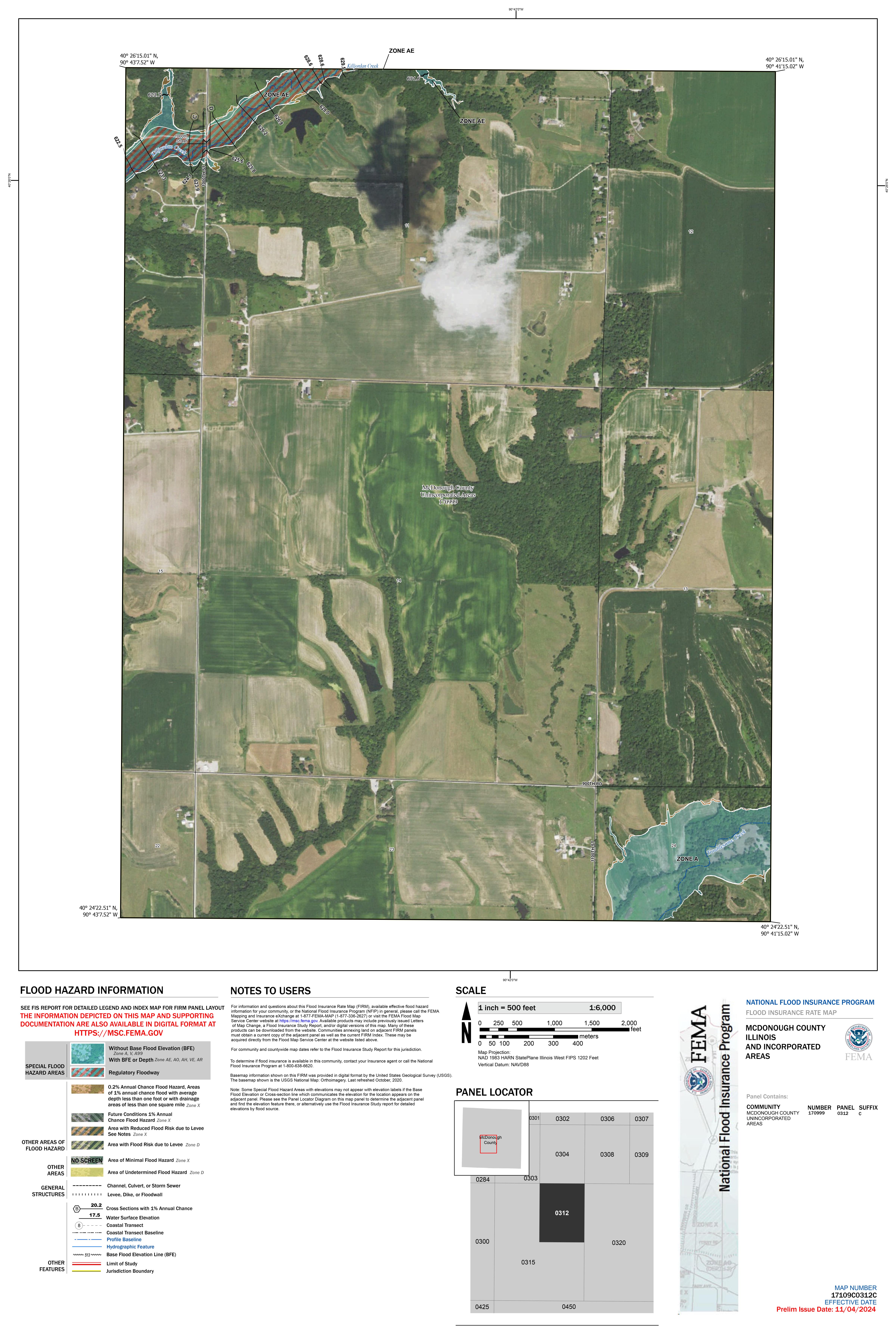
17109C0312C
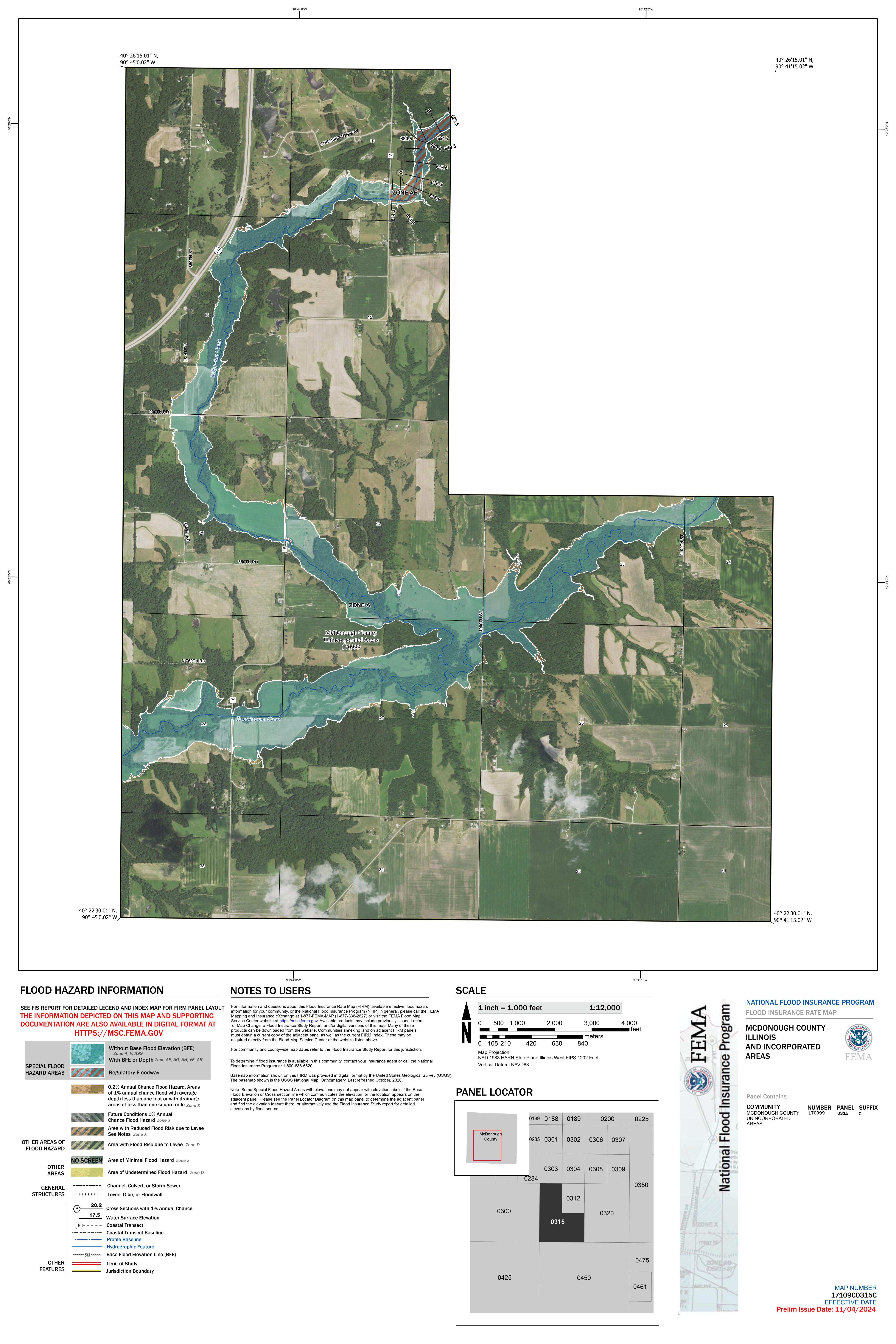
17109C0315C
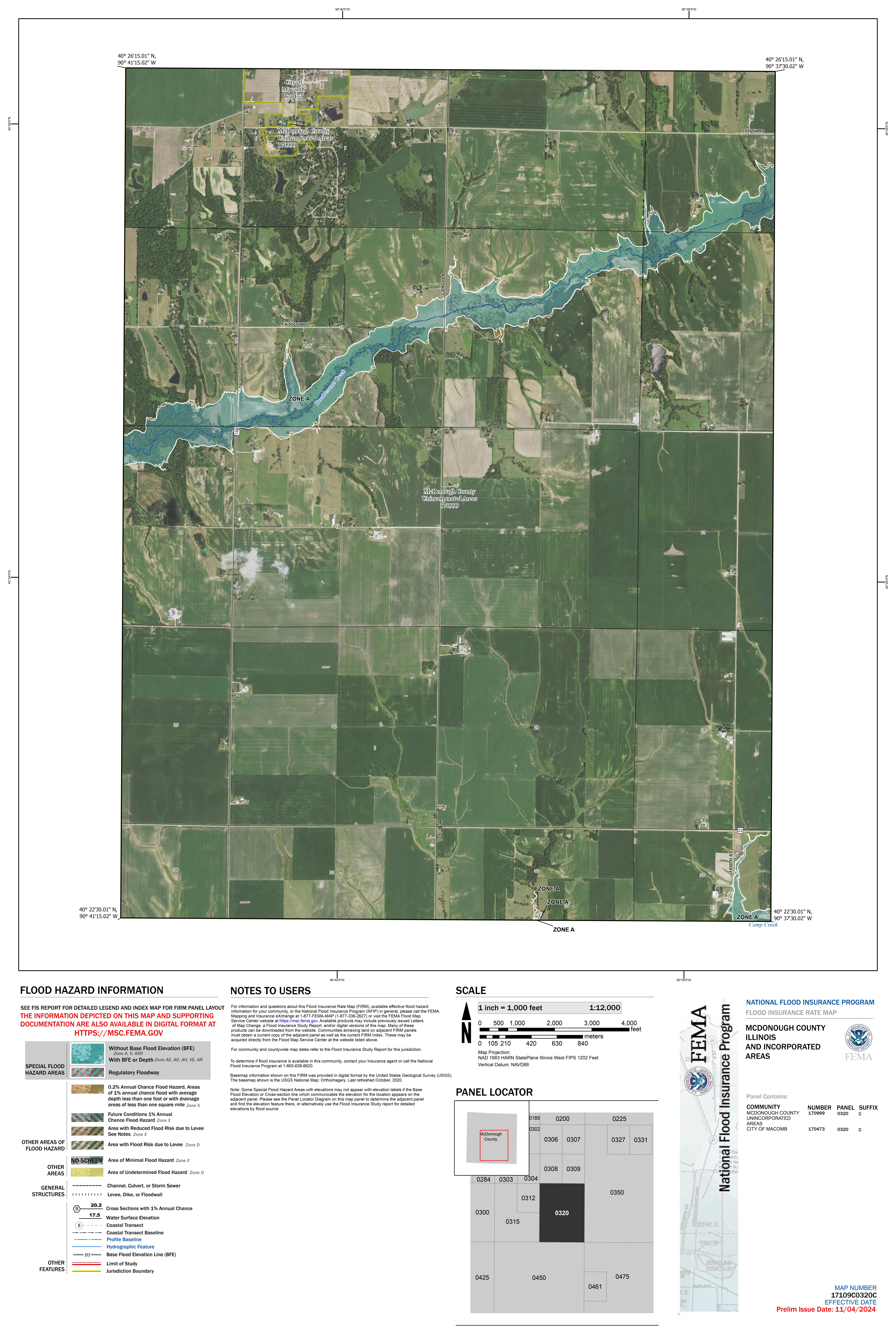
17109C0320C
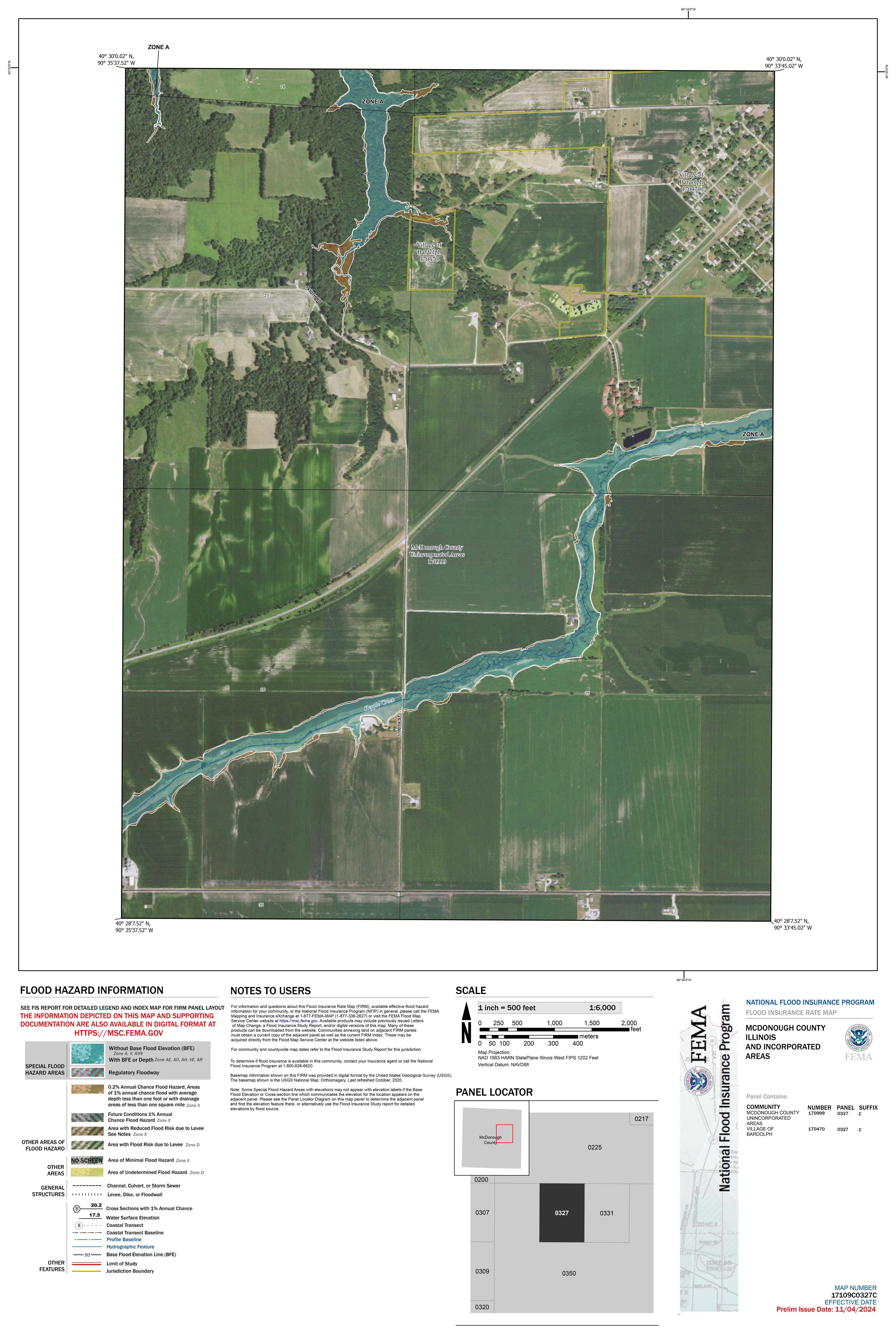
17109C0327C
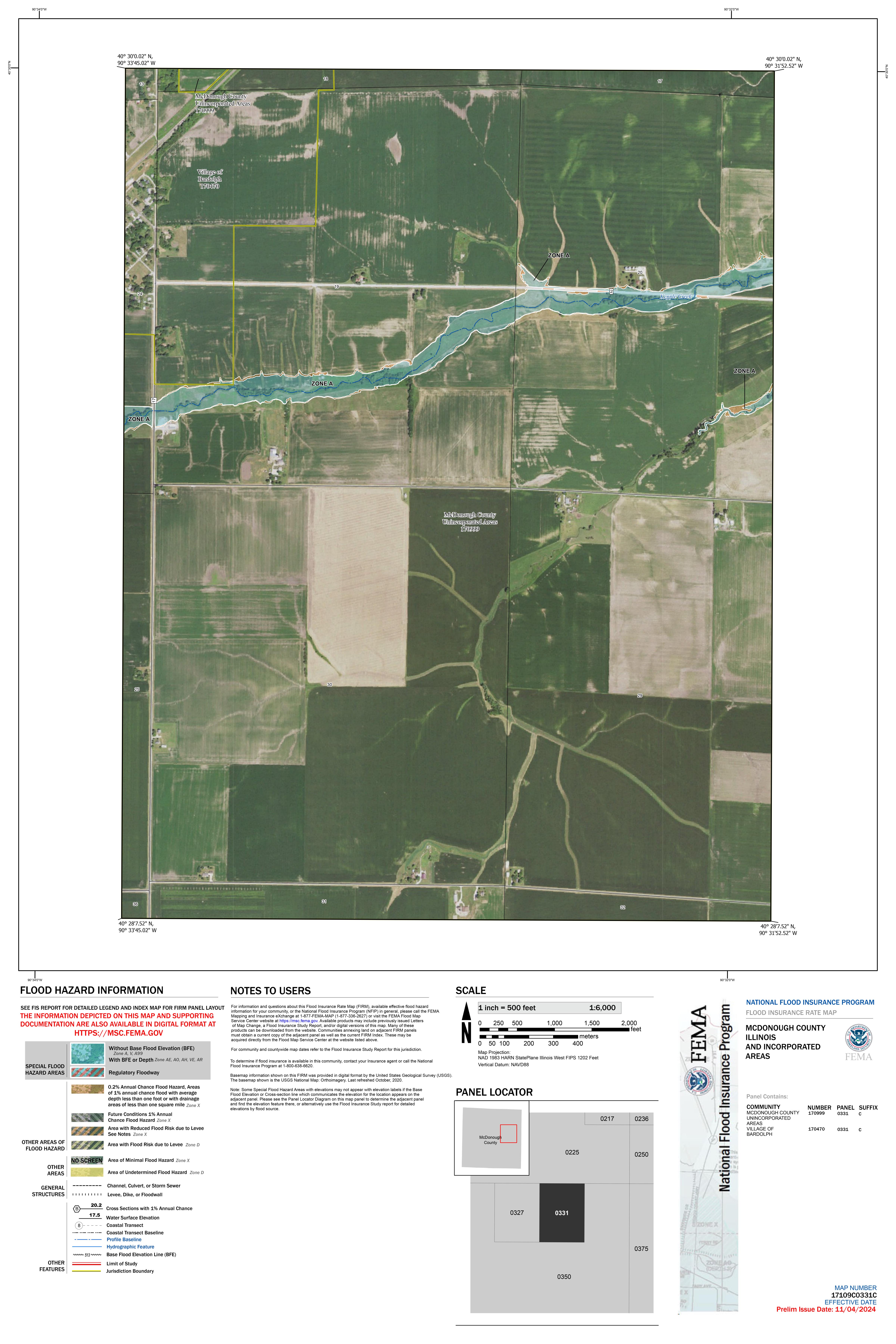
17109C0331C
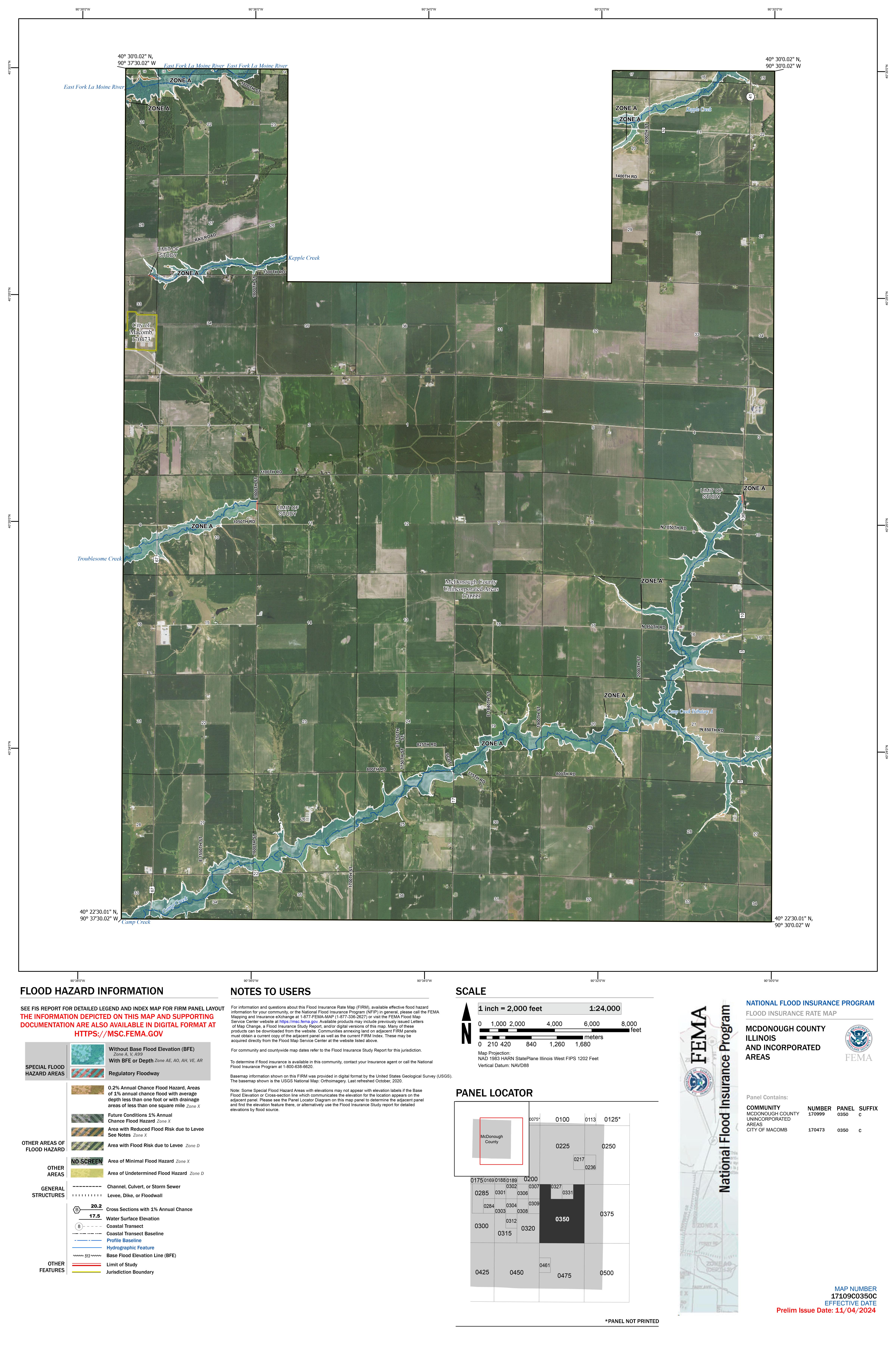
17109C0350C
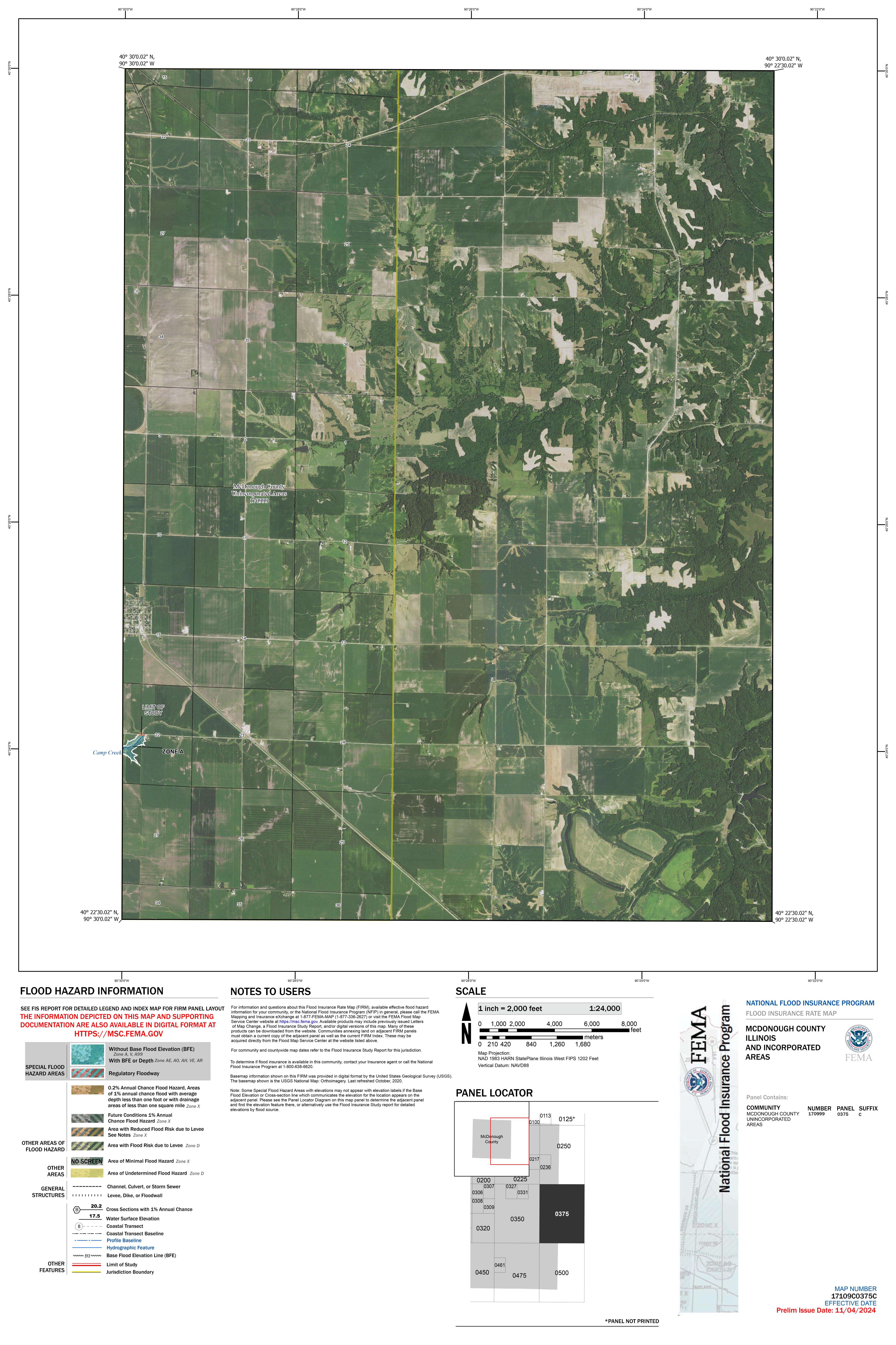
17109C0375C
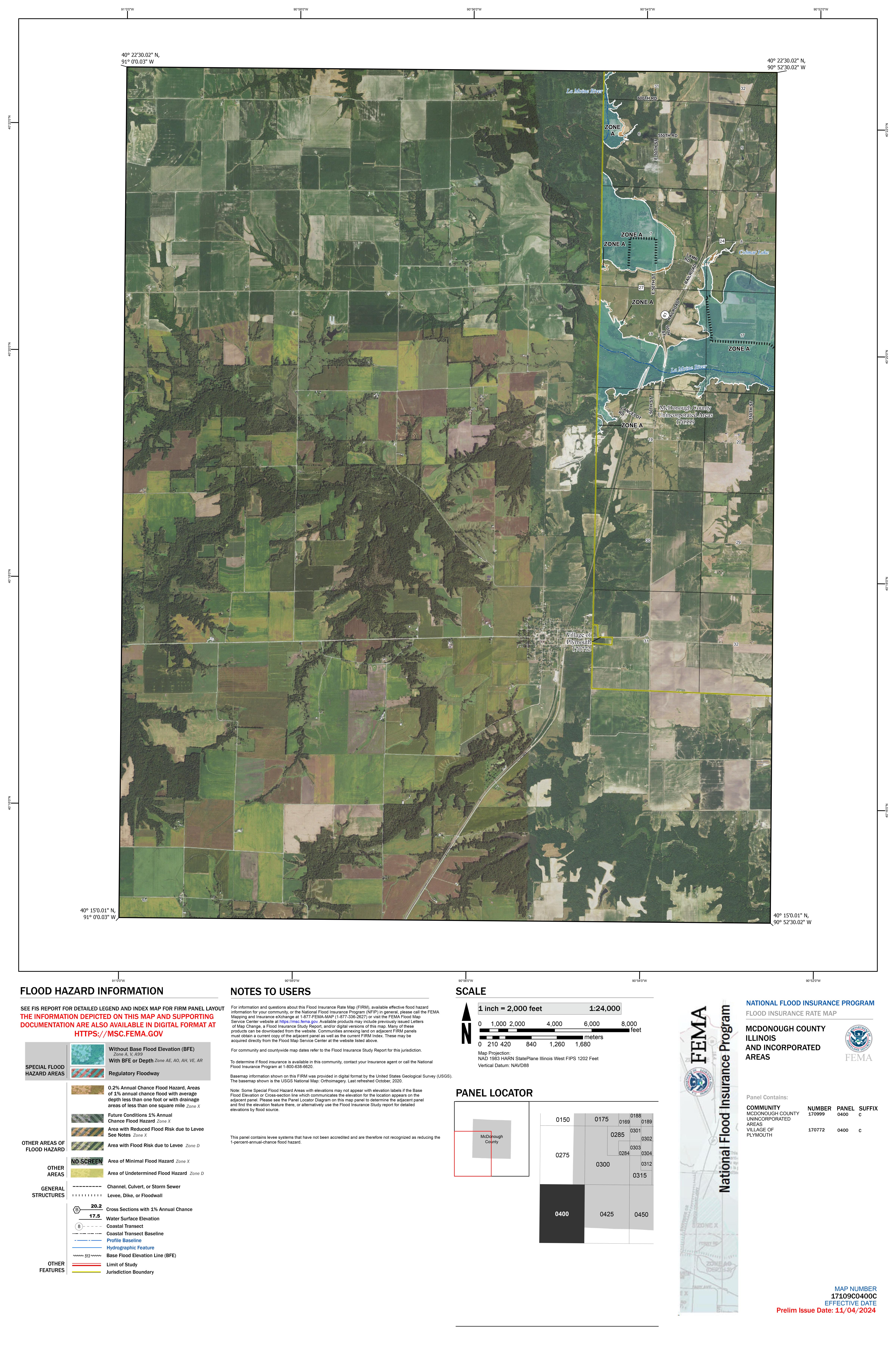
17109C0400C
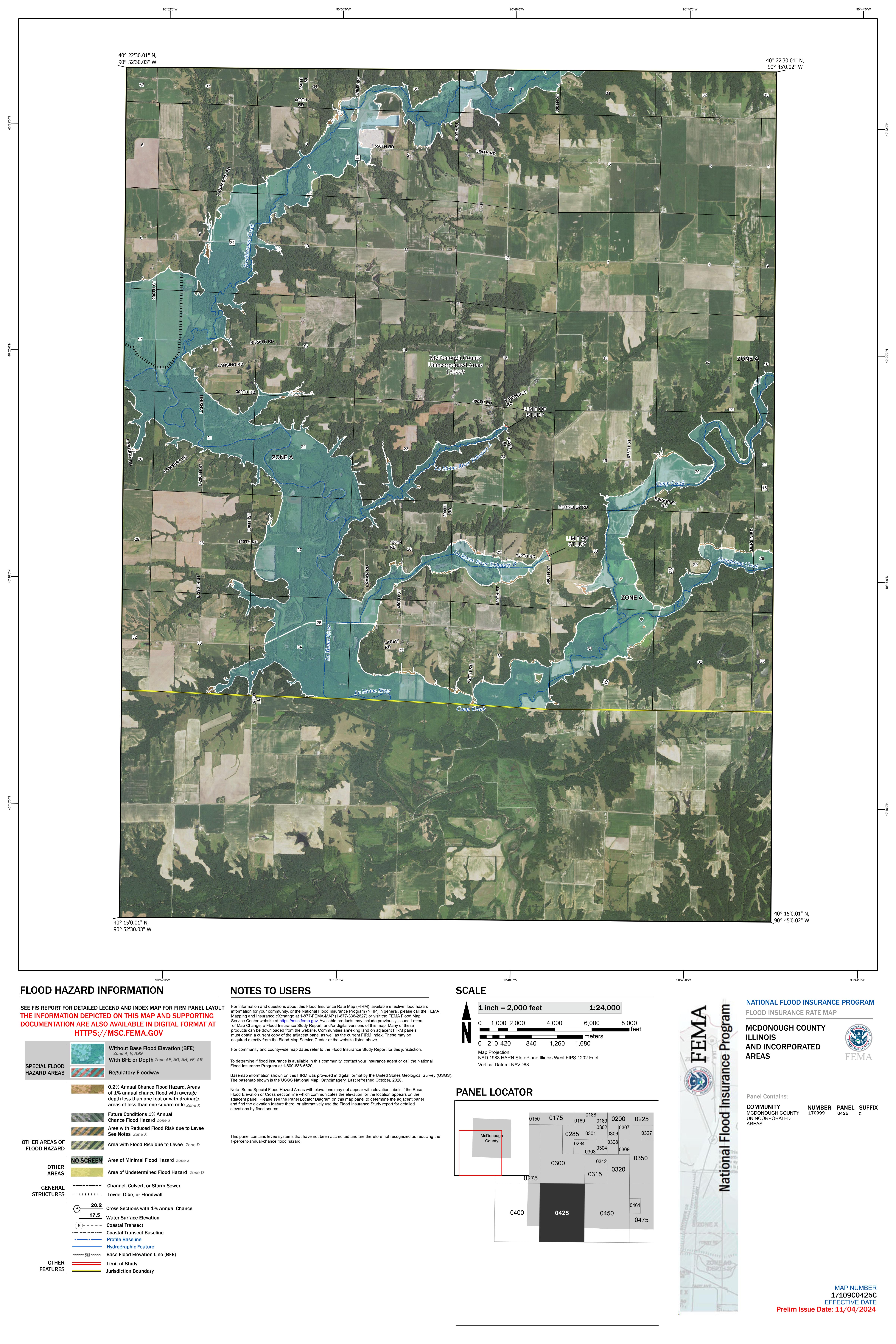
17109C0425C
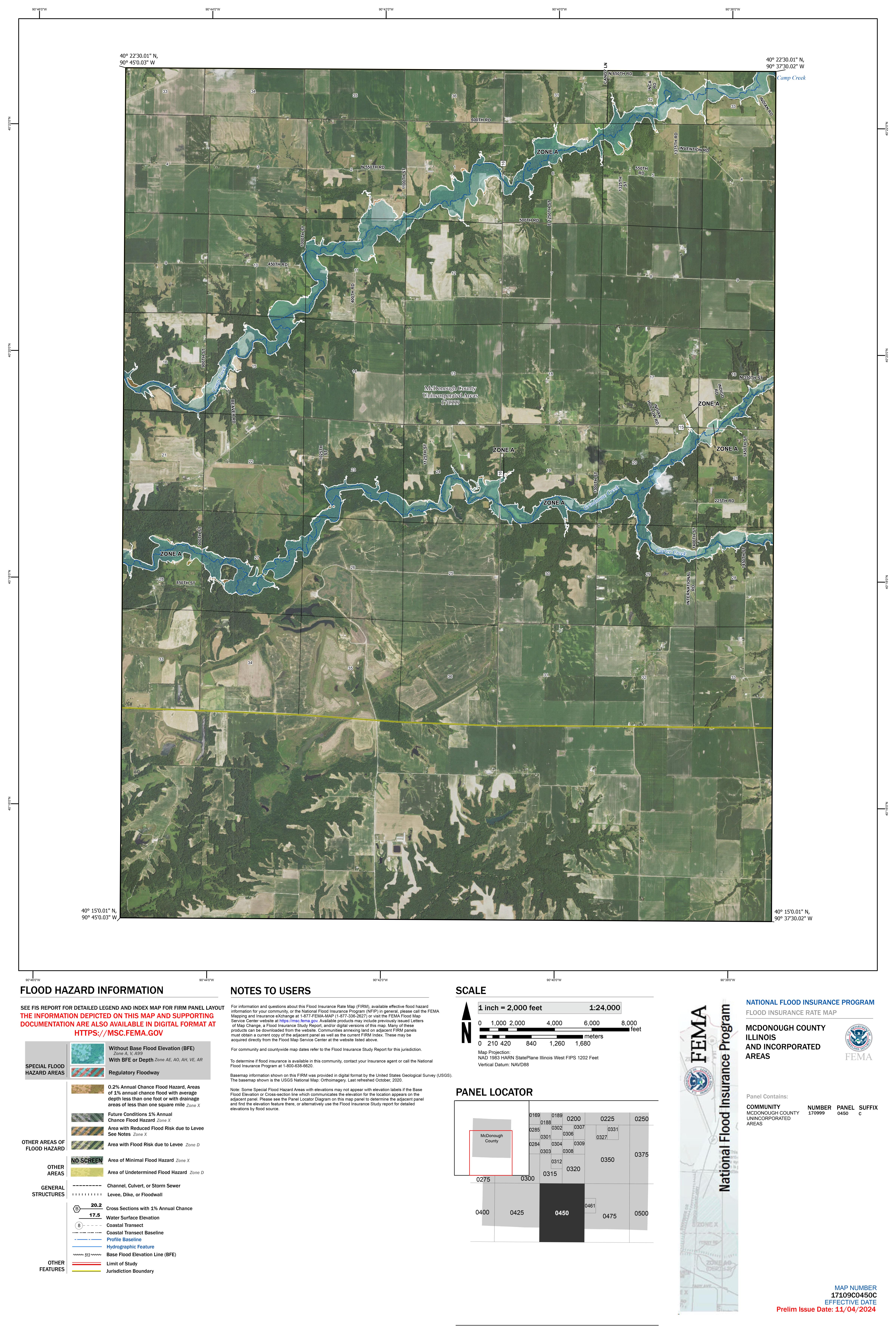
17109C0450C
17109C0461C
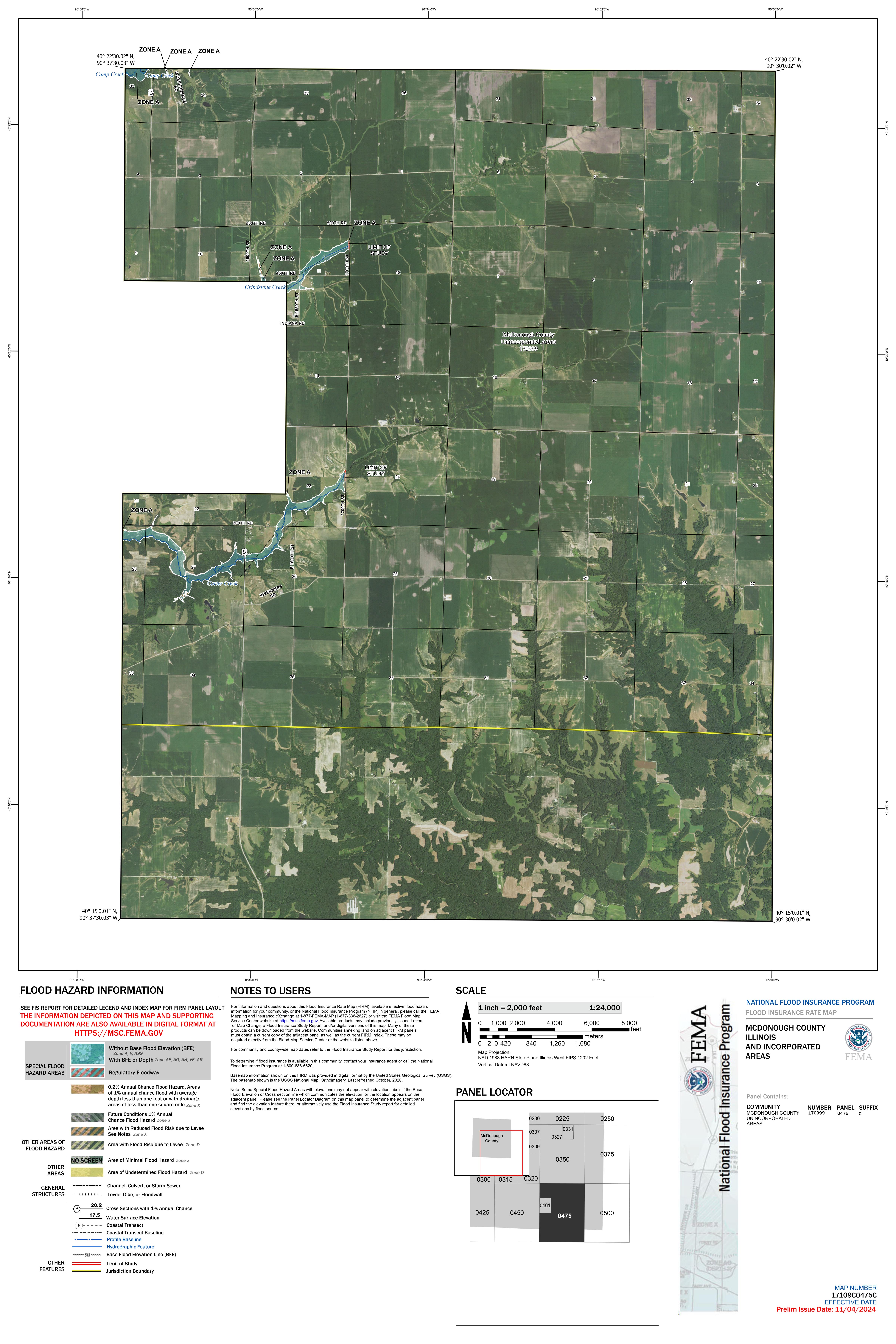
17109C0475C
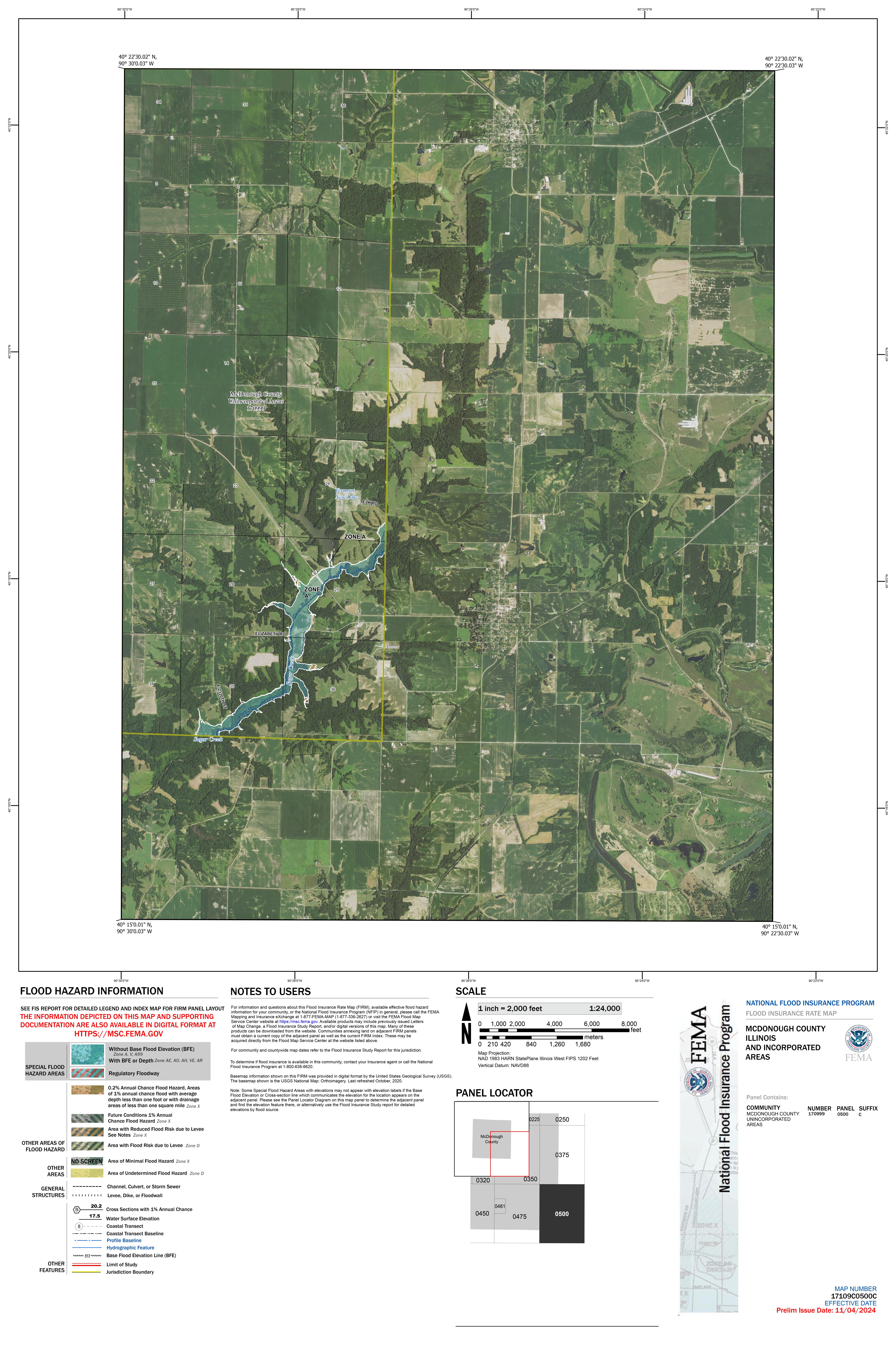
17109C0500C
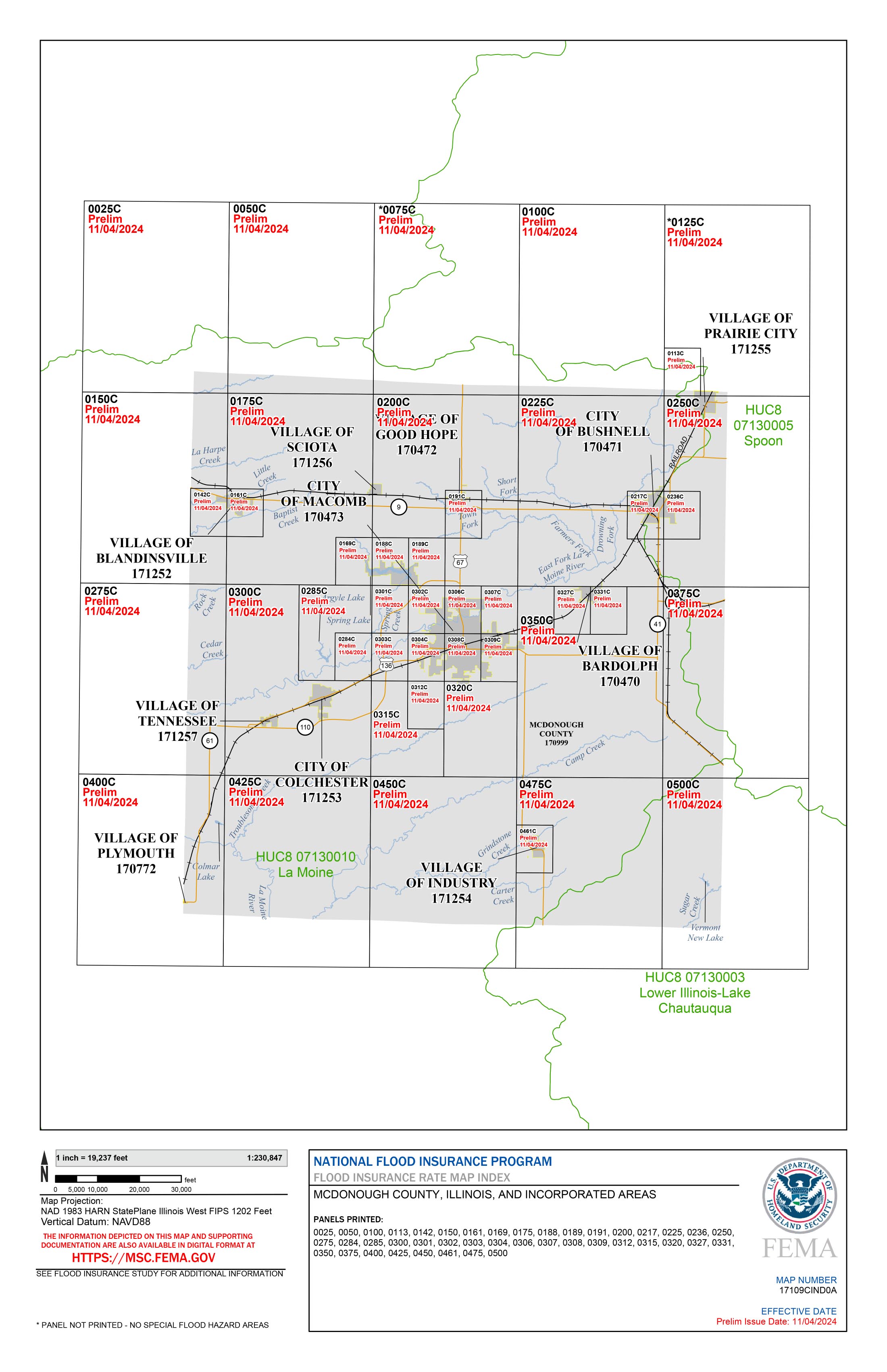
Index
Preliminary FIS
Preliminary FIRM Database
Download All (Panels, FIS, Database)
Changes Since Last FIRM
Consultation Coordination Officer (CCO) Meeting
4/23/2025
 Meeting Recording (hosted on Illinois Media Space)
 Meeting Presentation (PDF)
Data Development Phase
Flood Risk Review Meeting
5/18/2023
- Meeting Recording (hosted on Illinois Media Space)
- Meeting Presentation (PDF)
Project Initiation Coordination Call
10/13/2020
- Meeting Recording (hosted on Illinois Media Space)
- Meeting Presentation (PDF)
Additional Resources
- • Floodplain Mapping 101
- • Destined for DFIRMs
- • Building Footprints
- • Topographic Wetness Index
- • Links to National Flood Insurance Program (NFIP) Information
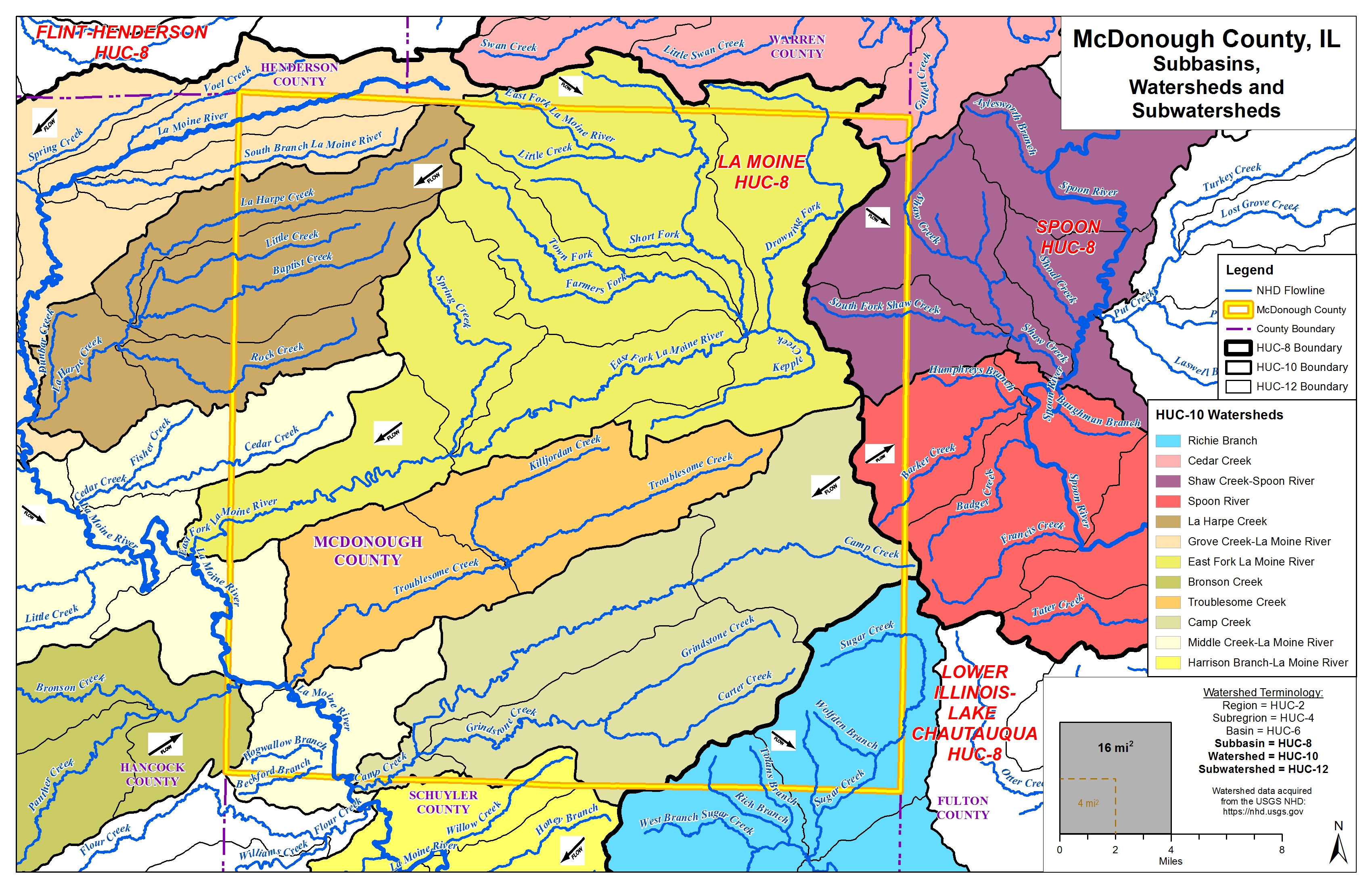
County Watershed Map
Frequently Asked Questions