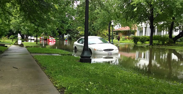
A residential street is flooded after nearly 5 inches of rain fell in
24 hours. Photo credit: Zoe Zaloudek
Urban flooding affects Illinoisians every year. As defined by the Urban Flooding Awareness Act (UFAA), it is "The inundation of property in a built environment, particularly in more densely populated areas, caused by rainfall overwhelming the capacity of drainage systems, such as storm sewers". As defined by the National Risk Index, Riverine flooding occurs when a water source like a river overflows its banks onto normally dry land. Unlike Riverine flooding, Urban flooding can happen regardless of an area’s distance to a river or lake.
The floodplains shown on FEMA Flood Insurance Rate Maps represent only riverine flooding. According to UFAA, "Over 90% of urban flooding damage [insurance] claims from 2007 to 2014 were outside the mapped floodplain". CHAMP is involved with projects studying urban flooding, including contributing to the report for the Urban Flooding Awareness Act. It has also worked with the Metropolitan Water Reclamation District of Greater Chicago on multiple reports. CHAMP staff are actively pursuing the development of an Illinois Integrated Water Information Center. Additionally, team members have created models and Story Maps of recent urban flooding events.
Urban Flooding Awareness Act (UFAA)
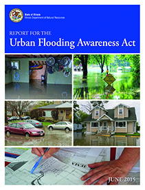
In 2014, the Illinois General Assembly tasked the Illinois Department of Natural Resources (IDNR) to prepare a report on the extent, cost, prevalence, and policies related to urban flooding in Illinois and to identify resources and technology that may lead to mitigation of the impact of urban flooding. IDNR prepared this report in collaboration with other state agencies, including the Illinois State Water Survey. It was released in June 2015.
IDNR webpage on UFAA (includes download links for report & appendices):
https://dnr.illinois.gov/waterresources/urbanfloodingawareness.html
University of Illinois IDEALS link to report:
https://www.ideals.illinois.edu/items/79381
Metropolitan Water Reclamation District (MWRD)
The CHAMP team has worked with the Metropolitan Water Reclamation District (MWRD) on a multi-phase project to examine the hydrologic and hydraulic impacts of stormwater retention and detention policies in the Greater Chicago region.
Illinois Integrated Water Information Center (IWIC)
As recommended in the 2022 Illinois State Water Plan, the Illinois State Water Survey and the other agencies that comprise the State Water Plan Task Force are working to establish and fund an Illinois Integrated Water Information Center (IWIC) in the Prairie Research Institute at the University of Illinois to foster interdisciplinary collaboration between Illinois state, federal and local agencies on water related issues including climate variability and related social and environmental justice considerations. IWIC would serve as a centralized location for water resource related information to inform and empower Illinois’ decision makers, program managers, emergency managers, community officials, home and business owners, and the public.
Flood Event Story Maps
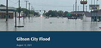
Gibson City Story Map
On August 12, 2021 a line of thunderstorms developed along southern Ford County, IL. Nearly 10 inches of rain fell in under 10 hours. This story map includes a model simulation produced by the Illinois State Water Survey, which shows the progression of the flood in Gibson City from the morning to the evening of August 12th. Photos taken during the flood are compared to the model results.
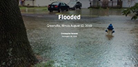
Greenville Story Map
On August 12, 2019, Greenville, Illinois received 9.34 inches of rain in 12 hours. Rainfall rates exceeded 2 inches per hour. Residents reported and documented street flooding, yard flooding, and basement flooding. This story map includes a model simulation produced by the Illinois State Water Survey, which shows the progression of the flood in Greenville. Photos taken during the flood are compared to the model results.
