A goal of RiskMAP is to work closely with communities to better understand local flood risk, mitigation efforts, and other topics and spark watershed-wide discussions about increasing resilience to flooding.
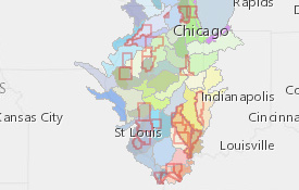
Current Risk Map Projects in Illinois are both watershed- and county-based.
